Complete List of Mountain Passes in India and Himalayas
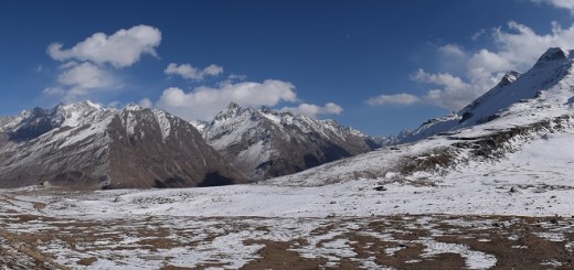
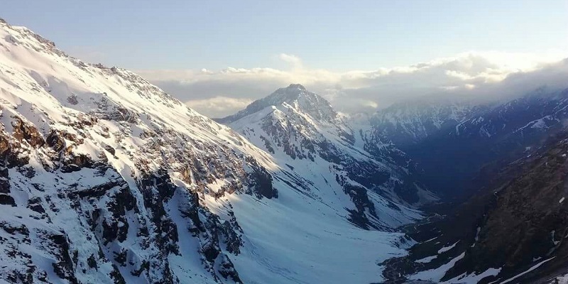
The Himalaya Mountain is the largest mountain Range in the world and it is situated in the northern part of India. Not only it hosts most of the highest peaks of the world but also some of the coldest places on the Earth. The Himalaya Mountain acts as a shield and separates India from the rest of Asia. The Himalayan Mountain Range runs for nearly 2400Km and it hosts some of the highest passes in the world. A Mountain Pass is route or path between mountain ridges which enables movement from one side of the range to another. Mountain passes are a very important geographical structure as they allow faster and easier transportation from one part of the mountain to another.
India is surrounded by two hostile neighbors in the north i.e. Pakistan and China and these Mountain passes in India give an edge to the Indian Army to move necessary reinforcement at the time. Not only the passes in India are helpful for the Army, but the passes in the Himalayas are also important for people living in Himalayan Valley. This Mountainous passes in allows local people to easily travel from one place to another and arrange necessary goods. In this article, we would be covering Passes in India and specifically Passes in Himalaya Mountain Range of India. We would cover some of the important mountain passes in India and their importance for the Indian Army, some of the highest mountain passes in the world and important valleys connected by these mountain passes in India.
Qucik Navigate:
List of Mountain Passes Situated in Himalaya Range in India
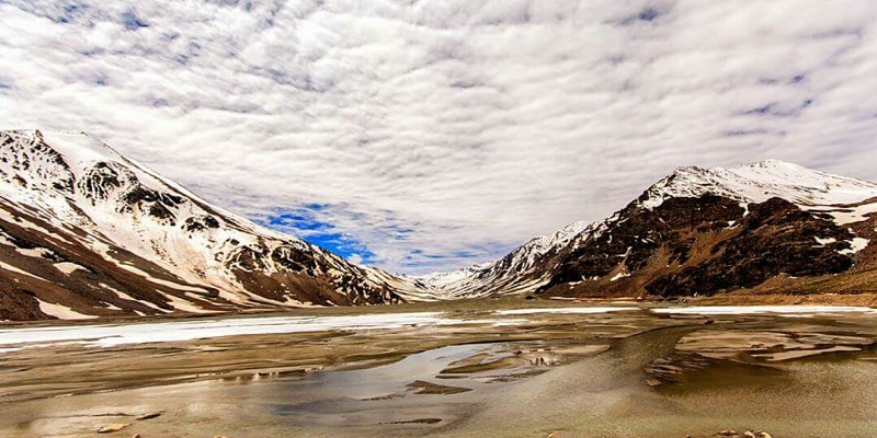
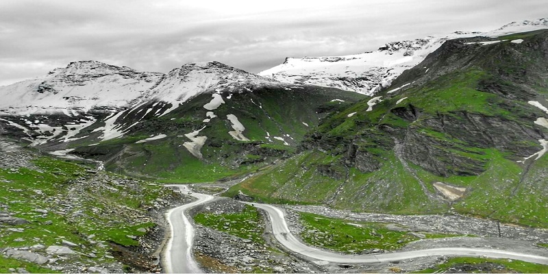
As mentioned earlier, Himalaya Range runs from Jammu & Kashmir to Arunachal Pradesh, thereby creating a substantial number of passes in India. The height of Mountainous passes in India varies from 2500 Meters (8000 feet) to 5500 meters (18000 feet). Almost every state of India through which Himalayan Range passes has a substantial number of passes. To better cover this article, we would list all the passes situated in India state wise with records held by them (if any). The Himalayan Range has nearly 40 Mountainous passes in India and they are predominately situated in 5-6 states of India.
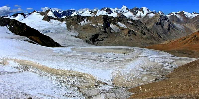
Mountain Passes Situated in Siachen Glacier in India
- Gyong La: Gyong La pass is situated in Siachen Glacier on the border between India and Pakistan. Gyong Pass is situated at an elevation of 5686 meters (18655 feet) and currently controlled by India. After the partition of India, the Gyong La Pass was controlled by Pakistan but after the success of Operation Meghdoot in 1984, the Indian Army launched another attack in 1989 and reclaimed the Gyong La pass from Pakistan. Since then the pass is administered by India.
- Sia La: Sia La pass is another pass situated in Siachen Glacier. Sia La pass is situated at an altitude of 5,589 meters (18,337 feet) and provides a gateway to Siachen Glacier. Sia La Pass was captured by the Indian Army from Pakistan in 1984 under Operation Meghdoot.
- Bilafond La: Bilafond La pass is situated in Siachen Glacier at an elevation of 5,450 meters (17,881 feet) and it was also captured by the Indian Army from Pakistan in 1984. India currently maintains a fortified military base at Bilafond La as it lies on the strategic Silk Road. The word Bilafond La “Pass of the Butterflies” and this pass lies on Actual Ground Position Line that divides current positions of Indian and Pakistani troops in the Siachen Glacier region. The Actual Ground Position Line is nearly 110 Km long that runs from Indira Col to NJ9842.
- Karakoram Pass: Karakoram pass is situated at an altitude of 5,540 meters (18,176 feet) and acts as a passage between India and China. In past, Karakoram Pass played a significant role in the flourishing trade on the Silk Route between India-China and Central Asia but in the year 1949, the pass was shut down. Karakoram Pass was one of the highest trade route in the world and the border between India and China is indicated by two heaps of stones at a distance of 50 feet, one at Indian side and other at Chinese side.
Mountain Passes Situated in State of Jammu & Kashmir in India
Banihal Pass: Banihal Pass is situated in the Pir Panjal Range of Himalayas and this pass connects the Kashmir Valley to the Jammu. Banihal Pass is situated at an altitude of 2832 meters (9290 feet) and gets close in the winter season. Jawahar tunnel and newly constructed Chenani-Nashri Tunnel provides connectivity in winter months between Jammu and Kashmir Valley.
Marsimik La: Marsimik Pass is situated in the Ladakh region of Jammu and Kashmir at an altitude of 5,582 meters (18,314 feet). The pass is very close to the India-China border and the City of Leh and Pangong Lake lies at a distance of 100KM and 40Km respectively. Marsimik La Pass also has a small temple dedicated to Lord Shiva called “Chak Mandir” but the entire stretch of road is not in decent shape and requires great skill to drive.
Sasser Pass: Sasser Pass is situated at an elevation of 5,411 meters or 17,753 feet in the Ladakh region. The Sasser Pass connects the Nubra Valley to the Shyok Valley. Sasser Pass lies 37Km South of Siachen Glacier.
Chang La: Chang La Pass is at an elevation of 5,360 meters or 17,590 feet in Ladakh Region of Jammu & Kashmir. Chang La Pass lies on Karu-Pangong Road while traversing from Leh to Pangong Lake. The word Chang La means “Pass towards the South” and it is situated at 80Km from Leh. The temperature at Chang La falls as low as -40°C and therefore Defence Research and Development Organisation (DRDO) has established a research station here which is the world’s highest research station.

Khardung La: Khardung la pass is an important pass for India and it lies at an elevation of 5,359 meters or 17,582 feet. It is through the Khardung La Pass that the Indian Army forwards supplies to Siachen Glacier. Khardung La Pass is falsely claimed as the “Highest Motorable Pass in World” but there is another motorable pass both in India and the world which are higher than Khardung La Pass. Khardung La pass is 40Km from Leh and 75Km from Diskit.
Also Read: Is Khardung La The Highest Motorable Road In The World?
Kongka Pass: Kongka Pass is at an elevation of 5,171 meters or 16,965 feet and lies at the disputed border of India and China (Line of Actual Control). China considers Kongka Pass as its boundary with India while India considers Lanak Pass (pass situated in Tibet Region) as the international boundary. Kongka Pass and Lanak Pass were important reasons which triggered the India-China War of 1962. Today Kongka La pass is one of the least accessible passes in the world not due to the altitude but because of the agreement between India and China.
Lungalacha La: Lungalacha La Pass is at an altitude of 5,059 meters or 16,600 feet on Manali-Leh Highway. Lungalacha La pass is nearly 90Km from Taglang La pass towards Manali and it is the last pass in Jammu & Kashmir before entering to Himachal Pradesh.
Fotu La: Fotu La Pass is at an elevation of 4,108 meters (13,478 feet) and lies on Srinagar-Leh highway. It is the highest pass that lies on Srinagar-Leh Highway and Leh City is 120Km from Fotu La Pass. Famous Lamayuru Monastery is only 15Km from Fotu La while Namika La Pass is approximately 35Km from Fotu La.
Zoji La: Zoji La Pass is the first Pass en route to Leh from Srinagar and it is at an elevation of 3,528 meters or 11,575 feet. The city of Sonamarg is 25Km from Zoji La pass and it is closer to the Machoi Glacier which is the source of Sind River and Dras River. The Coldest Place in India i.e. Dras is only 40Km from Zoji La pass.
Namika La: Namika La Pass is the second pass on Srinagar-Leh Highway en route to Leh and it lies in between Zoji La Pass and Fotu La Pass. It is at an elevation of 3,700 meters or 12,139 feet.
Pensi La: Pensi La Pass is at an elevation of 4,400 meters or 14,436 feet and it is also known as the Gateway to Zanskar Valley. Pensi La pass connects Suru Valley to the Zanskar Valley in Jammu & Kashmir. Drang-Drung Glacier which is one of the largest glaciers in the Ladakh region lies closer to Pensi La pass. Rangdum Monastery is only 25 Km from Pensi La pass.
Rezang La: Rezang La Pass is situated at an elevation of 4877 meters or 16000 feet on the south-eastern part of the Ladakh Province of India. Rezang La pass is closer to the Chushul Valley of Ladakh and there is a war memorial dedicated to the heroes of the 1962 India-China war.
Also Read: A Bike Ride To Chushul In Ladakh Valley
Shingo La or Shinkun La: Shingo La Pass lies at the border of Jammu & Kashmir and Himachal Pradesh and it is at an elevation of 5,091 meters or 16,703 feet. Shingo La pass connects the Lahaul Valley of Himachal Pradesh to Zanskar Valley of Jammu & Kashmir. Border Road Organization has constructed a 40Km long road connecting Lahul Valley to Zanskar Valley which passes through the Shingo La Pass and it has significantly reduced the travel time between these two valleys.
Mountain Passes Situated in State of Himachal Pradesh in India
Kunzum Pass: Kunzum Pass or Kunzum La is situated at an altitude of 4,590 meters or 15,060 feet in Himachal Pradesh. Kunzum Pass connects the Kullu Valley and Lahaul Valley of Himachal Pradesh to the Spiti Valley of the same state. Rohtang Pass is nearly 75Km from Kunzum Pass and high altitude Chandra Taal lake is only 18 Km from Kunzum Pass. The nearest town to Kunzum Pass is Batal but the pass remains closed from November to May every year.
Bara-lacha la: Bara-lacha la pass is at an elevation of 4,890 meters or 16,040 feet and it connects Lahaul Valley of Himachal Pradesh to the Ladakh region of Jammu & Kashmir. Bara-Lacha Pass is the second pass on Manali-Leh Highway en route to Leh. Suraj Tal or Suraj Lake which is the third-highest lake in India is situated only 4Km from Bara-lacha Pass. Bara-Lacha Pass acts as an intersection pass of Lahaul Valley, Ladakh Valley, and Pattan Valley.
Also read: Bike Ride to Chanshal Pass in Winter
Rupin Pass: Rupin Pass is situated in Dhauladhar Range of Himalayas in Himachal Pradesh at an elevation of 4,650 meters or 15,250 feet. Rupin Pass is also situated in Sangla Valley and Chanshal Pass is nearly 54 Km from Rupin Pass. In Himachal Pradesh, Rupin Pass is accessible from Shimla via Rohru and in Uttrakhand, it is accessible from Dehradun via Netwar Dhaula route. If you are accessing Rupin Pass via Dehradun then Govind Pashu Vihar Sanctuary lies en route.
Borasu Pass: Borasu Pass is at an elevation of 5,450 meters or 17,880 feet and it connects the Har Ki Doon valley of Uttrakhand to Kinnaur valley of Himachal Pradesh. Borasu Pass lies at the Border of Himachal Pradesh and Uttrakhand and Tibet are few kilometers from Borasu Pass.
Sach Pass: Sach Pass lies in Pir Panjal Range of the Himalayas at an elevation of 4,420 meters or 14,500 feet. Sach Pass is in Chamba District of Himachal Pradesh and connects Chamba Valley to the Pangi Valleys. Sach Pass is very important for the Indian Army as it reduces the distance by a huge margin to different areas of Jammu & Kashmir. Sach Pass is so crucial for Army that when the construction of the road on Sach Pass was going on terrorists killed 35 labors involved in the construction of the road.
Also Read: A Bike Ride To Sach Pass
Rohtang Pass: Rohtang Pass is a very famous pass that lies in the Himachal Pradesh of India at an altitude of 3,978 meters or 13,051 feet. Rohtang Pass connects the Kullu Valley to the Lahaul Valley and Spiti Valley of Himachal Pradesh as well as acts as a gateway for the Jammu & Kashmir Region of India. Rohtang Pass is nearly 50Km from the City of Manali and famous Leh-Manali Highway passes through it (National Highway 21). Rohtang Pass is one of the most visited Mountain Pass in India and therefore a number of travelers are restricted to maintain the pollution level in this area. Rohtang Pass is accessible between May to November and is closed for the entire winter season in India.
Mountain Passes Situated in State of Uttrakhand in India
Mana Pass: Mana Pass lies in Chamoli District of Uttrakhand at an elevation of 5,545 meters or feet 18,192 feet. Mana Pass is only 50Km from the Hindu Pilgrimage temple of Badrinath. Although people claim Khardung La as the Highest Motorable road in the World but in reality, its Mana Pass. Mana Pass lies on Border between India and Tibet and in ancient times it used to serve as a trade route between India and the rest of Asian Continent. Important places lying in the vicinity of Mana Pass are Nanda Devi Biosphere Reserve, Chaukhamba Peak.
Also Read: Bike Ride to The Holy Shrine of Badrinath
Auden’s Col: Auden’s Col Pass lies at an elevation of 5,490 meters or 18,010 feet and connects Rudugaira valley and Bhilangana Valley. It is situated in the Uttarkashi District of Uttrakhand and lies in between the famous tourist spot of Kedarnath Temple and Gangotri Temple. Auden’s Col is named after John Bicknell Auden, a geologist working with Geological Survey of India. He discovered the pass in the year 1935 and went on crossing in the year 1939.
Lipulekh Pass: Lipulekh Pass is a tri-point pass between India, China, and Nepal at an altitude of 5,334 meters or 17,500 feet. Lipulekh Pass connects Chaudans Valley of Uttrakhand with Tibet Autonomous Region of China. The route to Kailash Mansarovar is accessible via Lipulekh Pass and the pass also serves as a point of Border Personnel Meeting between India and China. Lipulekh Pass also serves as Border Trading Post between India and China and local people from both the country use this pass to sell their products across the border.
Sin La: Sin La Pass is situated in Pithoragarh District of Uttarakhand at an elevation of 5,495 meters or 18,028 feet. Sin La connects the Darma Valley to Kuthi Yankti valley. The trekking route to Sin La pass passes through India-Nepal Border and the Adi Kailash Peak is visible from Sin La Pass.
Nama Pass: Nama Pass is situated at an elevation of 5,200 meters or 17,100 feet in the Kumaun region of the Pithoragarh District of Uttarakhand.