Geography of India
The Geography of India is very diverse and almost all types of geographical divisions are present in the Indian subcontinent. The Geography of India is as diverse as its culture and languages. India is the largest country in South Asia, and it entirely lies in the northern hemisphere covering an area of 3,287,264 Km². The diverse geography of India allows it to have a variety of plants and animals. The Himalaya Mountain Range surrounds North of India and in south India is surrounded by the Indian Ocean. The Arabian Sea and Bay of Bengal surround it from the west and east. Since water bodies from three sides surround India, it is also known as the Indian peninsula.
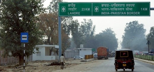
The Tropic of Cancer bisects India into two halves, and it passes through the Indian state of Gujarat, Rajasthan, Madhya Pradesh, Chhattisgarh, Jharkhand, Mizoram, and West Bengal. Neighboring countries of India include Afghanistan, China, Pakistan, Bangladesh, Bhutan, Burma, Nepal, and Sri Lanka. Excluding Sri Lanka, all the other countries share the land border with India. Sri Lanka and India are separated by the Palk Strait and Gulf of Mannar. From north to south total distance is 3,214 km whereas from east to west it is 2,933 km.
Qucik Navigate:
Division of Geography of India
The geography of India can be divided into six main geographical divisions. They are as follow:
- The Great Mountain Range
- The Northern Plains
- The Desert Region
- The Peninsular Plateaus
- The Coastal Plains
- The Island Group
The Great Mountain Range
Mountain range in India separates it from its neighboring countries. The mountain ranges of India play an important role in the geography of India. Himalayan Mountain Range runs from Jammu & Kashmir in the north to Arunachal Pradesh in the east. Himalayan Mountain is a group of young fold mountains, and it is the world’s largest mountain range. The Himalayas include nearly 100+ peaks having height more than 7000m and almost all the highest peaks of the world lie in it. In north-west India has Karakoram Mountain Range which lies mostly in the disputed area and K2 (Godwin-Austen) which is the second-highest peak of the world lies in it. In eastern front India has Garo–Khasi–Jaintia and the Lushai hills.
Read Also: List of Mountains and Mountain Ranges in India
The Himalaya mountain range has a significant impact on India’s climate as it prevents the cold winds from entering India and holds the monsoon winds within Indian Territory. The Himalayas are also the source of many perennial rivers of India like River Ganga, Indus, and the Brahmaputra.
The Northern Plains
Northern plains, also known as Indo-Gangetic plain is formed by alluvial soil deposited by rivers flowing in this area. Indus, Ganges, and Brahmaputra contribute mostly to these Great Plains. Northern plains cover an area of approximately 7 lac sq. Km with length and width varying from 2400 km to 300 km. These plains are one of the most densely populated regions of the world and are cultivated from the past 5000 years. Other famous rivers of the vast plain are Yamuna, Chambal, Ghaghara, Kosi Gomti, Sutlej, Ravi, Beas, and Chenab. Out of three main rivers mentioned the only Ganges flows entirely through India. Primary crops are rice and wheat.
The Great Indian Desert
The desert region of India is mostly situated in the Indian state of Rajasthan and is known as “Thar Desert.” It is the world’s 17th largest desert in terms of area. The Thar Desert is surrounded by Aravali Hills in the east, Rann of Kuchh in the south and Indus river in the west. This region receives very little rainfall as monsoon wind gets blocked by the Aravali Range. The only river that flows through this region is Luni, though now irrigation is also carried out by Indira Gandhi Channel. This region is also famous for Chinkara or Indian Gazelle.
Read Also: Amazing and Interesting facts About Ganges River Every Indian Should Know
The Peninsular Plateaus
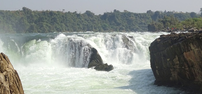
The region is dominated by three plateaus they are Malwa, Deccan, and Chota Nagpur Plateau. Deccan plateau is largest among these and Vindhya and Satpura ranges marks its northern boundary. The Deccan Plateau has an average elevation of 600m, which gradually decreases in the east. The degradation in slope causes most of the rivers in India to flow in the east direction and empty into the Bay of Bengal. The peninsular plateau rivers include the Godavari, the Krishna, the Kaveri, and the Mahanadi.
The mountain ranges surrounding the Deccan Plateau in east and west are known as the Western Ghats and the Eastern Ghats. They mark the western and the eastern edge of the Deccan Plateau. The Western Ghats are higher than the Eastern Ghats as the average elevation of Western Ghats is 900– 1600m and that of Eastern Ghats is 600m.
Read Also: List of Major Rivers of India and Their Tributaries
The Coastal Plains
The Coastal Plains are the landmass sandwiched between the Arabian Sea and the Deccan plateau in the west and Bay of Bengal and Deccan plateau in the east. Eastern coastal plains are wider than western coastal plains. Important rivers flowing in this region are Mahanadi, Godavari, Kaveri, and Krishna. The western coastal plain can be divided into Konkan Coast and Malabar Coast. The eastern coastal belt is known by Coromandel Coast. Eastern coast has deltas of Mahanadi River and Krishna-Godavari River.
The Island Group
The Island group mainly consists of Andaman and Nicobar Islands in the east and Lakshadweep in the west. Lakshadweep is comparatively smaller in size. India’s southernmost point i.e., Indira Point is situated in the Nicobar Islands. The island groups experience an equatorial type of climate owing to their closeness to the equator. The island group has a wide variety of flora and fauna and is a center of tourist attraction. Many other smaller divisions constitute the geography of India, but the important six division of geography of India has been listed here.