Ride To Krang Shuri Waterfall, Tamabil Check Post and Bamboo Trail In Meghalaya
As per my itinerary, today was my last day in Meghalaya, and I had to return Assam by night to start another leg of the journey in Assam. As per my initial schedule, today, I planned to explore Dawki, visit the India-Bangladesh Border, and then begin returning for Guwahati. When I was in Cherrapunjee, my homestay owner informed me about a famous Bamboo Trek in Wahkhen as well as he insisted on visiting the Krang Shuri Waterfall. Once I reached Dawki, I was in a dilemma on how to cover the Krang Suri Waterfall and Bamboo Trail in one day as they lie on different routes. For Krang Suri, I had to ride on Dawki-Jowai Road while for Bambook Trek in Wahkhen, I had to ride on the opposite side. The only solution I had for the above problem was to start early in the morning. Visit Krang Shuri Waterfall, return to Dawki and ride to Wahkhen for Bamboo Trek. After completing these and if time allows, then ride for Shillong or Guwahati. I knew it was a tight schedule as I planned to ride more than 200 kilometers and a trek, but I had no other options. Since today’s ride was my last day in Meghalaya, I didn’t want to miss anything important. As you all know, I had already skipped the western Meghalaya, i.e., Garo Hills, and I was not in a mood to miss anything offered by eastern Meghalaya. In today’s ride, I will be sharing my ride to Krang Shuri Waterfall, my ride to Tamabil Checkpost, and my Trek to Bamboo Trail in Wahkhen. I will also narrate how I managed to cover all these places in a short time. Stay tuned for another travelogue from my North-East India bike ride.
Ride To India-Bangladesh Border And Tamabil Checkpost
When I was a kid, the most common phrase I ever heard was “Early to Bed and Early to Rise, Makes Man Healthy, Wealthy and Wise.” Though I never followed this in my college days or my corporate days, today was the day to implement it for the first time. I slept early and woke up at 5 in the morning. In the eastern part of India, the sun rises early, and for the first time, I was going to take advantage of this fact. I planned to get a glimpse of sunrise from the border town of India before leaving Dawki. Though yesterday I was more concerned about finding accommodation rather than looking for a room with a perfect view. Yet I was lucky as the hotel where I stayed was situated adjacent to the Dawki river. By 6 AM, I was on the streets of Dawki looking for a Tea shop, and by 6:15 AM, I reached the Dawki-Tamabil Integrated Check Post.
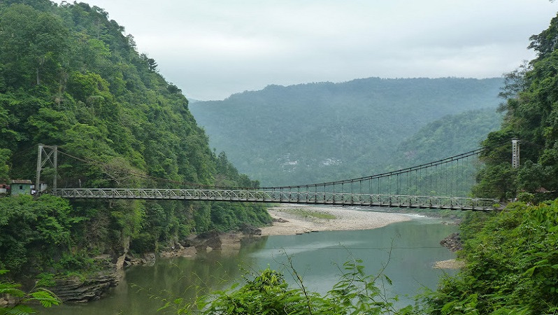
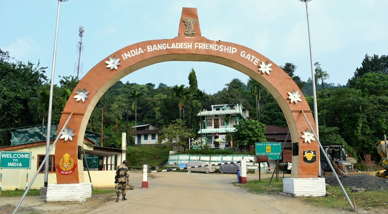
The Border Security Force, which is one of the five paramilitary forces in India, guards the India-Bangladesh Border. I saw a BSF personal at the check post, and soon, a casual “Hello” got converted into a conversation, and I had a good discussion with him. I asked where his hometown is and how long since he is in Meghalaya. We also discussed the cross border infiltration and significant problem faced by security personals here. He asked what I am doing here and my future travel plan. After a healthy conversation and a selfie, I inquired if I can visit the border and click a few pictures to which he answered in affirmation. I went to the zero point or the No-Man’s Land and clicked a few pictures. I also clicked pictures of India-Bangladesh Friendship Gate constructed on Checkpost. Once I was satisfied with the photos, I came back to the BSF post and met with the commanding officer. When I informed him about my travel plans, he also emphasized on visiting the Krang Shuri Waterfall and said he was there last week with his family. It was the second time someone recommended the Krang Shuri Waterfall, clearing all my doubts about visiting the waterfall.
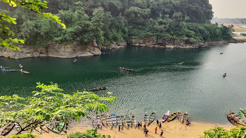
After visiting the Dawki-Tamabil Integrated Check Post, it was my turn to explore the Dawki town. The main attraction is the Dawki River, which flows through the town and knows as Umngot River locally. Shnongpdeng village is one of the most visited places and an ideal site for camping and water sports. As I had already done a lot of camping and water sporting in my previous trips to other parts of India, I was not inclined to do it here. Yet I thought to go for boating and then head for Krang Shuri. I went to the counter from where everyone was booking their boat and struck a deal for 300 rupees. Sailing in the water of the Dawki river is an altogether different experience as the river is not deep, and water is calm and clear. As I was in Dawki during monsoon, the river was muddy, yet gave me an idea of how clear the water would be once the rainy season is over. The Dawki River forms the boundary between India and Bangladesh in Jaintia Hills, where India is on one side, and Bangladesh on the other side. Here the boatman took me to the point were Indians are allowed and then started rowing for another side of the riverbank. The boat ride went for 30 minutes, and I was so amazed by the water that I couldn’t refrain from taking a bath and decided to take a dip in the river. After bathing, I went to the BSF camp nearby and discussed the fencing of the India-Bangladesh Border. The security personnel informed me that due to the harsh terrain in Meghalaya, fencing is difficult, but it is complete in India-Bangladesh Border in West Bengal and Tripura. The clock was ticking 9:30 AM, after a good talk, I started my bike, and now my target was to reach Krang Shuri Waterfall.
Ride To Krang Shuri Waterfall
Also Read: A Complete Travel Guide To Krang Shuri Water Fall
As mentioned earlier, the Krang Shuri Waterfall lies on the Dawki-Jowai road, some 30 Kilometers from Dawki. I checked Google Maps, and it suggested one hour, and I aimed to reach Krang Shuri By 10:30 AM. On the road to Dawki-Tamabil Checkpost, five hundred meters before the check post, there is a board on the left-hand pointing route to Jowai. When I started riding on the road, I was amazed by its condition as the road was smooth and looked like regularly maintained. National Highway 206, which connects Shillong to Dawki, also connects Dawki to Jowai. Jowai is the district headquarters of West Jaintia Hills district of Meghalaya. The road hardly had any traffic, and all I can see was hills surrounded by trees reminding me of my previous day ride. I expected it would take an hour to reach Krang Shuri, but in 45 minutes, I reached the town of Ammutong. From here, I exited the main highway, and in the next 5 minutes, I was at the parking point of Krang Shuri Waterfall. From the Parking point, one has to trek down to the base of the waterfall and takes 20-25 minutes on average. The Meghalaya Tourism Department has constructed a viewpoint to view the waterfall, and they provide the best view.
A 15 minutes walk took me to the bottom of the waterfall, and a glimpse of the waterfall was sufficient to conclude that visiting Krang Shuri was not a mistake. The bluish water was dropping from the edge of a plateau and falling in a pool beneath. After clicking photos, I started walking towards the water stream, which forms the waterfall. Due to the monsoon season, the flow has sufficient water making waterfall to flow in its full might. The site also has a boating facility and an ideal place for a family picnic, and now I remember why the BSF personnel insisted me to visit the waterfall. After spending some 30 minutes, I went to the nearby restaurant for breakfast as I was riding an empty stomach from the morning. After breakfast, it was time to return Dawki as I planned to reach at least Shillong by evening. The Krang Shuri Waterfall is splendid, and no matter how many photos you take, pictures can’t justify its beauty. There is one viewpoint at the top which provides a bird’s eye view of the waterfall. I went to the viewpoint and again clicked a few more photos. Once the photography session was over, I stated for Dawki by 11:30 AM and planned to reach Wahkhen by 2 PM for the Bamboo Trek. While returning, I rode fast compared to when I was riding for Krang Shuri and took around 35 minutes to reach Dawki. The highway from Krang Shuri to Dawki and Dawki to Shillong is an ecstasy for any motorcycle rider. In my short span of traveling on Motorcycle, I had hardly encountered highways like this in India.
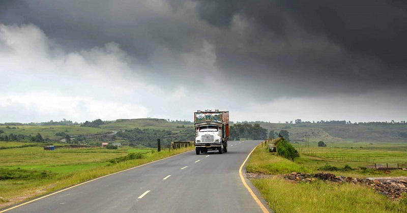
From Dawki, Laitkynsew is around 45 kilometers, and from Laitkynsew, Wahkhen is another 15 kilometers. Google Maps showed two hours to cover the distance, and I aimed to cover the distance in an hour and thirty minutes. I started from Dawki and rode on the same road on which yesterday I came to Dawki. I was still able to recognize the shops and bends, which I memorized while coming and felt sad about leaving this beautiful area. No matter how much I praise about the highway, words can’t describe the joy of riding on this highway. I took thirty minutes to reach Pynursla and stopped for a small tea break.
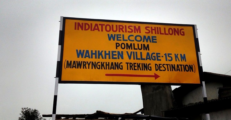
After a short break, I was back on my riding seat, Wahkhen was still 30 Kilometers to go, and I decided to stop once I reach Wahkhen. I started from Pynursla around 1 PM and though to cover the remaining distance in 45 minutes. While riding in this stretch, I crossed markets such as Langkyrdem, Rngain, and Mawkajem. Once I reached Laitkynsew, I took the exit from the highway and started riding on Laitkynsew-Wahkhen road. The road is not as good as the one I was riding earlier but well maintained, considering it connects villages and not a big town. The Wahkhen road was good in the beginning but started deteriorating once Wahkhen started approaching. I took further thirty minutes and reached the point where the Bambook trek starts. Though I had heard a lot about the Bamboo Trail of Meghalaya, when I arrived there, I found no one. Initially, I thought I arrived at the wrong place as there was no one to assist me. The owner of the only shop present there didn’t understand Hindi/English preventing any communication. While I was searching for help to get an idea of the trek, I found the same group of tourists who stayed with me in the homestay in Cherrapunjee. While shaking hands I said, the world is a small place and look here we met again. They had already gathered the information, and now all I had to do was to accompany them.
Return from Wahkhen To Shillong
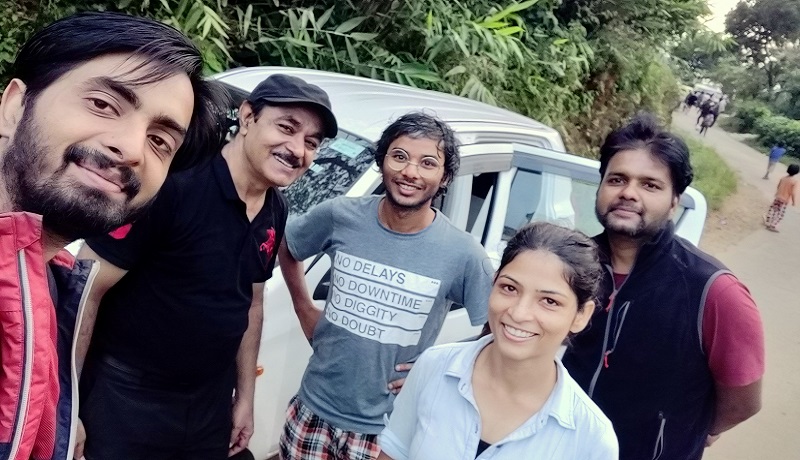
By 4:30 PM, we finished our trek to the Bamboo Trail, and it started getting dark. Since in the eastern part of the country, the sun sets earlier, I had one hour before it gets completely dark. Though I had ridden on the Shillong route and knew the road is good, I was in a dilemma whether I should ride in the night or not. I decided to reach Shillong and then to determine if I can ride till Guwahati or I should halt in Shillong. We all ordered tea from the shop and discussed everyone’s plan after this trek. While I informed that I would be heading to Assam, the uncle told me that he would be returning to Delhi, and the other couple had their flight for Banglore. After finishing our tea, we posed for a group photo and Selfie and bid farewell to each hoping to meet in the future. By 5 PM, I started from Wahkhen towards Shillong and hoped if everything goes fine, I will reach Guwahati by 9 PM. By the time I reached Laitkynsew, I felt some issue with balancing my bike. The bike was bubbling, making it hard to maintain balance. Initially, I thought it might be due to a flat
After reaching Lāitlyngkot, I found one mechanic and asked him to inspect the reason behind this strange behavior. He was not able to find the cause and suggested that there might be some issue with the bearing of the rear
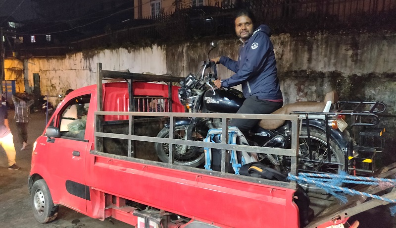
By 8, I reached Shillong, and the pick-up van driver drooped me at the motor market of Shillong. I went to one shop and explained the situation. After unloading the bike, he thoroughly inspected the bike and found that most of the spokes of my rear

