Bike Ride To Dawki-Mawlynnong Village And Living Root Bridge: Day Four In Meghalaya
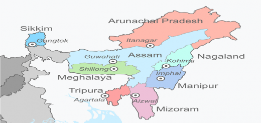
Welcome to another day of my Ride to North East India. If you have read my previous post, you would know that I am traveling to Meghalaya. In the last three days, I had covered most of the popular places to see in Cherrapunjee, and now I planned to explore other parts of Meghalaya. Meghalaya comprises of three hills or regions; they are Garo Hills (Western Meghalaya), Khasi Hills (Central Meghalaya) and Jaintia Hills (Eastern Meghalaya). The Garo Hills hosts some of the major tourist attractions of Meghalaya, like Balphakram National Park and Siju Cave. Initially, I planned to go to the Garo Hills, but due to time constraints, I dropped my plan hoping to visit in the future. As per my itinerary, I had allocated five days for Meghalaya and after spending three days in Cherrapunjee, decide to move towards the Jaintia Hills of Meghalaya. Today, I planned to ride to the border town of Dawki, famous for the crystal clear water of Umngot or the Dawki River. I also planned to visit the Mawlynnong Village and Living Root Bridge in Riwai Village. Mawlynnong is famous for holding the title of “Cleanest Village in Asia,” while Living Root Bridge is another root bridge in Jaintia Hills of Meghalaya. In this article, I will be sharing my bike ride to Dawki from Cherrapunjee, Mawlynnong Village, and Living Root Bridge. I will also share any other famous tourist attraction on the Cherrapunjee-Dawki Highway or National Highway 206.
Qucik Navigate:
Bidding AIDEU to Cherrapunjee Or Sohra
My stay in Cherrapunjee was memorable, and the last three days passed in a flash. I was lucky to explore so many places in a short period and also covered most of the famous tourist destinations of the town. Though exploring Cherrapunjee will take more than 15 days, but none of us get so many holidays, and we have to utilize the time we get. Since today I planned to ride from Cherrapunjee to Dawki (90 Kilometers), I had plenty of time to explore some less famous/visited places in town and on the highway. I planned to visit some notable buildings in the city before saying a final goodbye to Cherrapunjee. I had three sites in my mind, the Ramakrishna Mission Cherrapunjee, St John Bosco Shrine, and Sohra Church. I started from Sohra Church, also known as the Church of God, and then went to St John Bosco Shrine. In both cases, I visited them from outside and moved to the next.
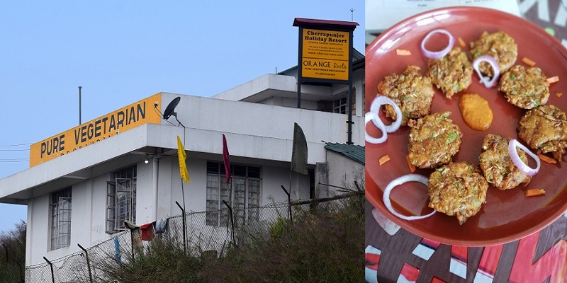
My last destination was Ramakrishna Mission, where I went inside the building and saw the architecture and got to know about its history. The institute was founded in the year 1931, and since then, it’s working for the education of children of the Khasi Hills tribe. The institute not works in the field of education but also provides vocational training to women and children. Another reason for visiting the Ramakrishna Mission was my admiration for Swami Vivekananda and in the past, wrote an article on my blog in the year 2015. I took 45 minutes to cover all the three places as they were situated close to each other. I rode for five kilometers to cover all, and by 10 AM, I was ready to leave the town and start riding for Dawki. I aimed to reach Dawki by evening, and I had plenty of time to explore any place lying en-route on the Cherrapunjee-Dawki Highway. Once I crossed Chreeapunjee, I stopped at a restaurant outskirts of the town to have breakfast as I was uncertain of the availability of food on the highway. Moreover, being a vegetarian, I always have limited options, especially in Noth-East India. After a 30 minutes break, I was back on my motorcycle, ready for another memorable ride.
Ride From Cherrapunjee To Dawki In Meghalaya
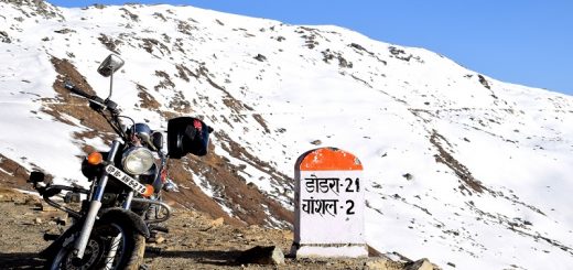
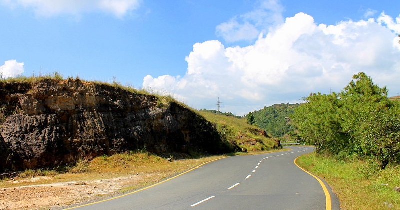
As mentioned above, today’s ride was shorter one, approximately 100 kilometers from Cherrapunjee to Dawki, and google maps showed two and a half hours to complete it. The route to Dawki from Cherrapunjee is as follows: Cherrapunjee-> Laitryngew-> Lāitlyngkot-> Pynursla-> Dawki. I had an intuition that road is going to be good as I rode on Cherrapunjee- Lāitlyngkot while coming to Cherrapunjee. The Lāitlyngkot-Dawki being a National Highway, was expected to be in a good state. I started riding on the highway, and this time I was enjoying the hills of Meghalaya. When I was coming to Cherrapunjee, I remember it was dark, and therefore I was involved more in riding rather than enjoying the hills. Now today, it was day time and I can see all the forest, hills, and numerous bends, and riding on it was fun. Any biker can relate to the joy of riding on hills when there is less traffic, and you feel like you own the road, and I had a similar feeling. It was a sunny day, and no sign of clouds, but I knew sooner the sunset is, the roads will be covered by fog.
I took one hour and reached Umlympung. At Umlympung, one way goes to Shillong, second to Cherrapunjee and the last one to Dawki. I continued on Umlympung-Dawki road, also known as National Highway 206. Riding on this stretch is a bliss. While Cherrapunjee-Umlympung road also passes through the hills but frequent markets and traffic hindered the speed. As soon as the Umlympung-Dwaki route started, the road got wider, and traffic negligible. Driving on this highway is a different experience altogether. The highway acts as a boundary between the Khasi Hills and Jaintia hills as well as the eastern border of Cherrapunji-Mawsynram Reserve Forest in Jaintia Hills. The road is a single lane connecting the Shillong to Dawki. Dawki is an important ICP (Integrated Check Point) on India-Bangladesh Border. Through Dawki, a lot of cross border trade takes place, but no truck on the road surprised me.
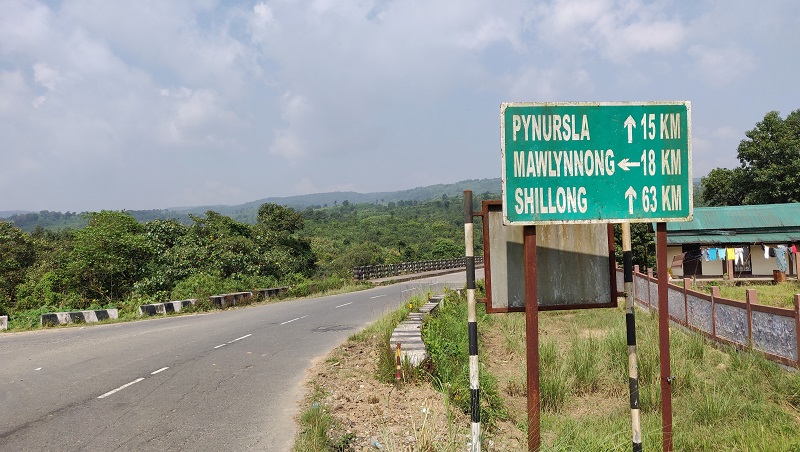
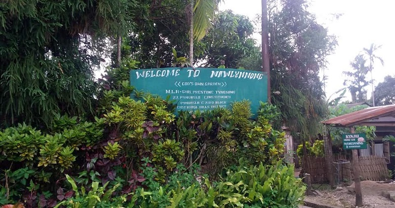
After riding for another hour, I noticed a market approaching as the road got four-laned, and shops started appearing on both sides of the road. It had been two hours since I started riding and thought of taking a small tea break. I went to one shop, ordered tea, and asked about the place. The shop owner informed me that this is the town of Pynursla and also the biggest market on this highway. After the tea break, I started riding again, and my destination was Mawlynnong Village which is famous for being the cleanest village in Asia. From Pynursla, Mawlynnong is around 30 kilometers. Once I reached Pongtung, I took the right turn and continued my journey towards Mawlynnong Village. By 2 PM, I was in Mawlynnong Village and ready to explore the “Cleanest Village of Asia.” One more reason for visiting the Mawlynnong village was its proximity to Living Root Bridge. I had already visited the double-decker root bridge and single root bridge; now, it was time to see the Living Root Bridge and see if it is different from other root bridges or not.
Visiting Mawlynnong Village And Living Root Bridge
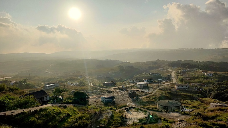
Once I reached the Mawlynnong Village, I parked my bike and started exploring the village. It looked like the place deserves fame as every lane, home, and corner was clean. Residents of the village have designed dustbin from the Bamboo tree, and I found one in front of every house. The whole town was clean and way above the cleanliness standards of India. I have seen my village and hometown, and when I compared with Mawlynnong Village, they were nowhere in cleanliness standards set by the village. Though I appreciated the cleanliness initiative, it looked to me now that the cleanliness is more due to the tourist inflow. Since tourists come because the village is famous for cleanliness, villagers had to keep it clean as tourism is now a significant source of income. I saw many homestays in the village, proving the villagers were the direct beneficiary of tourism. After walking and exploring through the village for 30 minutes, I decided to proceed for the Living Root Bridge.
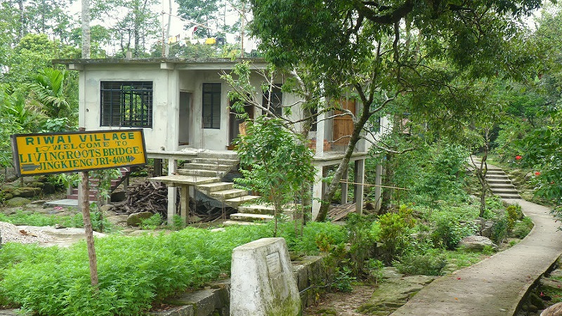
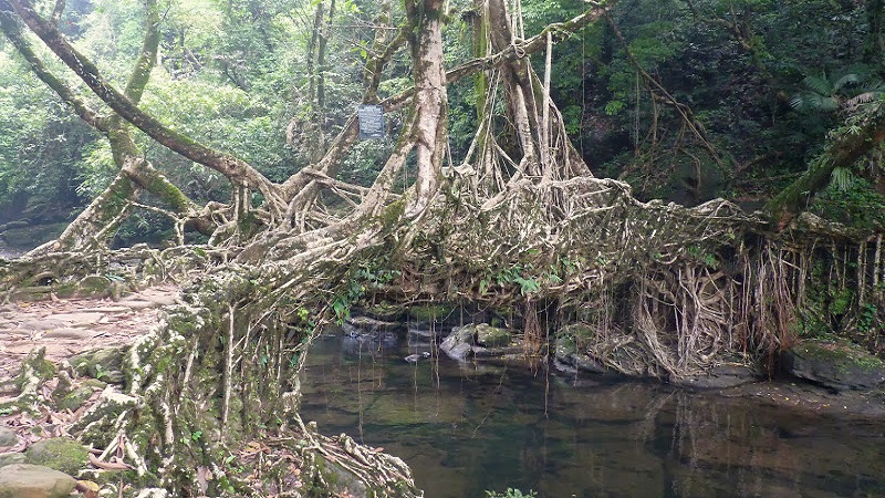
The Living Root Bridge is in the Riwai Village, which is close to the Mawlynnong Village. After reaching the Riwai village, I started walking towards the Living Root Bridge. It took me fifteen minutes to reach the Living Root Bridge, and it looked similar to other root bridges in Meghalaya. The only difference was the trek route, while the double-decker root bridge requires a demanding trek, reaching the living root bridge is quite easy. So, someone who wants to see the root bridge and not interested in trekking, the Living Root bridge is the best option. The Living root bridge in Riwai village spans over a stream and looked like the bridge serves its purpose during the monsoon. After spending a considerable amount of time at Living Root Bridge, I returned to the parking point of Mawlynnong Village and decided to start riding for Dawki.
Ride From Mawlynnong Village to Dawki
From Mawlynnong, there are two ways to reach Dawki. The more common route is the highway connecting Dawki to Shillong on which I rode till Pongtung. Google Map showed one alternate route which runs parallel to the India-Bangladesh Border. It looked like a differed route, and I decided to ride on the second route suggested by Google Maps. The route was as follow: Riwai-> Nongeitniang-> Iarsohliang-> Burhill Waterfall-> Dawki Waterfall-> Dawki. As mentioned earlier, the road passes close to the India-Bangladesh border, and I saw the Bangladesh Plains from the road. A small stream of Dawki River also runs parallel to the border and forms a natural border between India and Bangladesh. On this route, there are many waterfalls like Burhilll Waterfall, Dawki Waterfall and Songrampunji Waterfall. As I had already seen many waterfalls in my three days ride, I skipped most of them and focused on riding. As Dawki started approaching, the road started getting worse. For the last 30 kilometers of my ride, I took one hour thirty minutes ad finally reached Dawki. By the time I reached Dawki, it was 6 in the evening and dark and I had no idea where the main center of the town is. I crossed a bridge on Dawki river (I assumed it is Dawki River) and after riding for a few hundred meters, I entered into the main town.
Once I entered the town, my next task was to find a hotel for a night stay and to my surprise, I found none. I rode till the Tamabil Check Post and returned, but didn’t find a single building having a hoarding which says Hotel. The reason for getting no hotel might be the dark or me riding a bike and paying less attention to the premises. Whatever might be the reason was, it was sufficient for me to get tensed and I went to the riverside camp to find accommodation. I inquired from 2-3 operators, and their rate doesn’t looked reasonable, forcing me to drop my plan to stay in a tent. I thought to give one more try to find accommodation in the town and started searching for hotels. Luckily this time, I saw one named Hotel Ganga View and sealed the deal for INR 800. After riding for a hundred kilometers and walking for five kilometers, it was time for rest. After putting my luggage in the room, I went straight to a nearby restaurant and had my dinner. After another memorable day on the road, it was time to get a memorable sleep.
Thanks for reading. Continue my next journey here: Ride To Krang Shuri Waterfall