The Bamboo Trek of Meghalaya: A Complete Guide To Mawryngkhang Trek
In my short history of traveling in India, I have done a lot of bike rides and treks. I have completed a bike ride to Leh-Ladakh, Spiti Valley, and many more popular biking routes in India. I have also completed treks like Valley of Flower, Dayara Bugyal, Panch Kedar, and many more. Now I was in North-East India and my last leg of the journey in Meghalaya. After visiting the Tamabil Check Post and Krang Shuri Waterfall, it was time to visit the famous Bamboo Trek of Meghalaya. While I was in Cherrapunjee, I undertook the trek to the Double-Decker Root Bridge, which was different from traditional treks in India and, now I was trying another unique trek. The Bamboo Trek in Wahkhen village is unique in its way. The trek passes through lush green hills, water stream and provides ample points to take amazing shots of the Khasi Hills. The most notable feature of this trek is that the whole trek is to be done by walking on a trail created by bamboo rafts. The Bamboo Trek of Meghalaya not only showcases the natural beauty of the state but also exhibits how skillful the people in North-East India are. Locals living in these areas have learned how to get the best from nature, and the Bamboo Trail is the best example of it. Throughout my ride to North-East India, I saw Bamboo being used in everyday life, and now here it was used to climb a hill. The Bamboo Trek of Meghalaya is also known as Trek to Mawryngkhang or U Mawryngkhang Trek. While the name bamboo trek is self understandable, I will explain in the latter part of the article why the trek is also known as the Mawryngkhang Trek. Therefore, in this article, I will be describing my trip to Bamboo Trek of Meghalaya, how to reach the Bamboo Trek of Meghalaya. I will also explain the amenities available there, and why one should venture the Bamboo Trek. I hope my article would be helpful to all the readers in completing their Mawryngkhang Trek or the Bamboo Trek in Meghalaya.
Qucik Navigate:
Where Is Bamboo Trek Situated In Meghalaya?
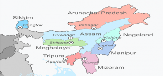
The Bamboo Trek of Meghalaya lies in the Wahkhen Village in the East Khasi Hill District of Meghalaya. East Khasi Hill district is the most populous district of Meghalaya’s eleven districts with its headquarter in Shillong. Wahkhen is a small village in the Cherrapunji-Mawsynram Reserve Forest Reserve and located in Pynursla Tehsil of East Khasi Hills district. The Wahkhen village is 30 kilometers from the sub-district headquarter Pynursla, and 50 Kilometers from district headquarter Shillong.
How to Reach The Bamboo Trek of Meghalaya
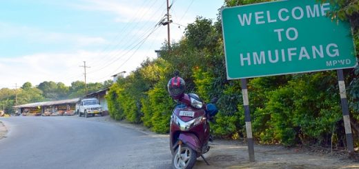
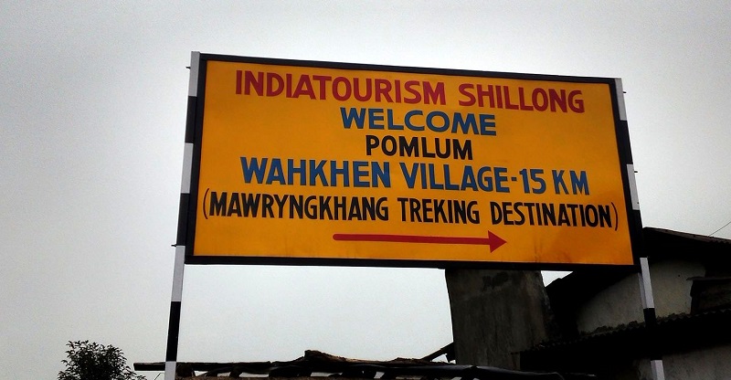
Since the trek lies in the most populous district of Meghalaya, the connectivity of roads is better compared with other areas of Meghalaya. The Wahkhen village lies 15 kilometers from the main highway (National Highway 206) connecting Shillong to Dawki, and the road is asphalt. To get an idea of this highway, you can read my previous post about my ride to Dawki. Wahkhen village is about 50 kilometers from Shillong, and a two-hour ride will take you to the Wahkhen village. From Shillong, one has to ride till Mawkajem (Pomlum), and after reaching Pomlum, you will see a big board saying “Mawryngkhang Trekking Destination.” Exit the main highway and carry on the Wahkhen village road for another 15 kilometers. From Mawkajem, the condition of the road will start deteriorating, and by the time you reach Wahkhen, it will be a combination of pebbles and tar. After reaching Wahkhen village, you can ask locals for the Mawryngkhang trek or the Bamboo trek. It is advisable to ask Mawryngkhang trek as locals are not much familiar with the Bamboo Trek. I faced a similar problem once I reached there as the majority of the local population doesn’t speak Hindi or English. There is a notice board “Tourist Information Center Wahkhen,” and the trek route starts from there.
The Story of Mawryngkhang & Bamboo Trek
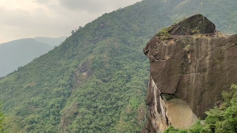
One thing I noticed during my travel to Meghalaya was that most of the places have a unique name, and the names are derived from some folklore or ancient story. For example, the Dainthlen Falls is named after a python, whereas the Noh-Ka-Likai falls on a local Khasi woman. The Bamboo Trek also traces the story from Mawryngkhang or U Mawryngkhang. According to the Khasi Folklore, there used to be a king of stones called U Mawryngkhang. He was handsome and powerful, and he defeated all the stones who challenged his supremacy. After establishing his reign, one day, during his visit to the kingdom, he fell in love with a female stone. But like the famous Bollywood movies where lovers never meet before undergoing hardship, the neighboring kingdom’s stone king U Mawpator waged war on Mawryngkhang’s territory. In the ensuing battle, Mawryngkhang came out as a winner but lost his one arm, and the intruder Mawpator was killed. Since then, U Mawryngkhang is referred as the king of stones in Khasi history. Thus the Bamboo trek is a trek to reach the top of a huge rock, which is U Mawryngkhang or the stone king in Khasi lore. The rock stands tall, chopped from one side. The trek route passes through a few more rocks, which are portrayed as the female rock and the U Mawpator. The top of U Mawpator rock has a flat top resembling a decapitated head. These rocks can be viewed from the top of Mawryngkhang.
Time to Cover the Bamboo Trek, Facilities En Route, And Fees
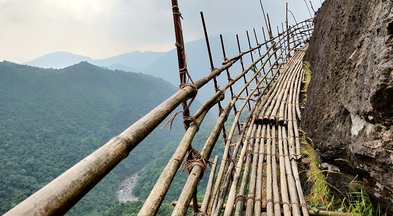
The total time to finish the Bambook Trek in Wahkhen is between three to four hours. There might be a slight difference in time, depending upon speed as well as time spent at the top, but four hours can be taken as standard. It is better to allocate four hours for the trek if the trek is on your list. Additional hours for the time to reach the Wahkhen village. I would have completed the trek in less than three hours, but I had to wait many times for other members of my group with whom I was undergoing this trek. The trek is similar to other mountain treks, and the only difference is the bamboo rafts replace the usual trail. The gradient of trek is uniform barring a few points, and therefore, the trek can be undertaken by an older person. While walking on the bamboo rafts, it is advisable to hold the handrail to avoid any unpleasant experience as the surface might be slippery.
Regarding facilities on the en route, there are no shops or amenities available. It is better to carry water bottles and edible things before commencing the trek. Once I started trekking and walking for a few hundred meters, I saw a river, and no other water source afterward. Hence it is recommended to carry water bottles and ensure you don’t throw them anywhere.
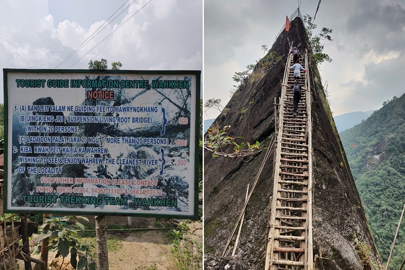
One more thing to keep in mind before beginning the trek is the availability of the guide. I don’t know if this is mandatory or not, but the notice board at the beginning of the trek says so. The notice board is in the Khasi language, yet going by the numbers, I got an idea about the guide charges. When I started my trek, initially, it looked like a simple trek and no use of a guide. Later on, the guide looked mandatory as there were different routes within the trek. A guide fee of 500 rupees is to be paid for a group with less than 20 members and 1000 for more than 20. I faced an issue with finding a guide, and that part, I will explain in the latter part of the article.
My Trek to The Bamboo Trail Of Meghalaya
If you have read my previous post, you know, after visiting the Tamabil Check Post, I reach Wahkhen around 1:30 PM. After reaching Wahkehn, I searched the entry point of the trek but couldn’t find it. I went to the nearby village to inquire if anyone has an idea about the trek, but the language barrier prevented me from getting an idea. I returned to the point where I had parked my bike, and to my surprise, I found the group with whom I stayed in Cherrapunjee. They also came for the trek, and their driver knew the beginning point of the trek. Finally, we all reached the point where the trek starts and the notice board outlined the trekking rules. If the group consists of less than 20 people, a fee of rupees 500 has to be paid and 1000 for more than 20. Now I was part of a group, the charge looked reasonable, and we started searching for a guide who can accompany us in our trek. One boy from the nearby shop said he could be our guide, and we were not sure if he fits the criteria of guide or not. With no other option in hand, we agreed and asked if he has been to the top of the trek to which he replied in affirmation. He said he has been twenty times to the peak and works as a guide, and so does the other children in his village. We agreed and asked him to lead us and we started following him.
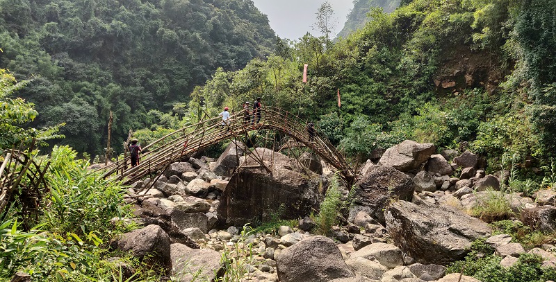
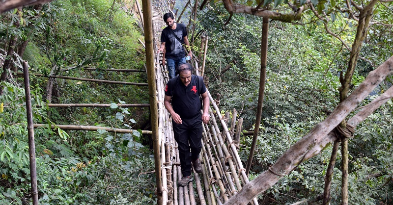
In the beginning, we walked over a farm cultivated with crops by walking on the bamboo rafts. It looked like we are walking in a plantation just not touching the ground. Once the rafts ended, we started walking on a mucky path and started descending. In another 15 minutes, we reached near the bank of the river, and our guide informed us that the river is known as Umrew. To me, it looked more like a water stream rather than a river as the water flow was normal. Anyways, without questioning the knowledge of our small guide, I continued following him. To cross the river, we took the bamboo bridge built over the river. It felt like a walk in the Anaconda movie of Hollywood; just there was no anaconda here. Once we crossed the bamboo bridges, the real trek started, and we all started climbing on a bamboo ladder running adjacent to the hill. On this route, I experience the craftsmanship of Khasi people who came up with such a unique construction. At many points, there was no place to fit a bamboo, yet locals managed to create the path, and the whole construction looked robust. I was walking fast, but my group consisted of an elderly uncle, and I had to wait for him to keep the group whole. I utilized the time in clicking photos, and whenever I was waiting, my camera was in action. Initially, the trek route has a gradual ascent, but once the trek and river deviate, the trek became steep. After a 45 minutes walk, I got the first glimpse of the valley from the top of one rock. From the top, the Umrew river looked smaller, and all I can see was the hills covered with dense trees. We took a break, and I asked our guide where the destination is, and he pointed out towards a huge rock with the flag on top. I examined the path, and indeed, the path was going in that direction.
We again started our trek, and this time I started a conversation with the boy and tried knowing about him and his family. The boy informed me that he has seven siblings in which two sisters are younger than him. His father works in a manufacturing shop in Shillong, and his elder brothers are working as daily waged workers with no fixed income. His mother works in the village community, and he works as a part-time guide for this trail. I felt sad for him, but like most of the stories in India, I was not in a position to help much. I asked about his education, and he replied that he goes to the nearby primary school. He has planned to join his father in Shillong one he passes his class 10th examination. I explained to him the importance of graduation and why he should continue his studies until he is graduated to which he nodded in affirmation. Now it was his turn to ask questions, and I was on the hot seat.
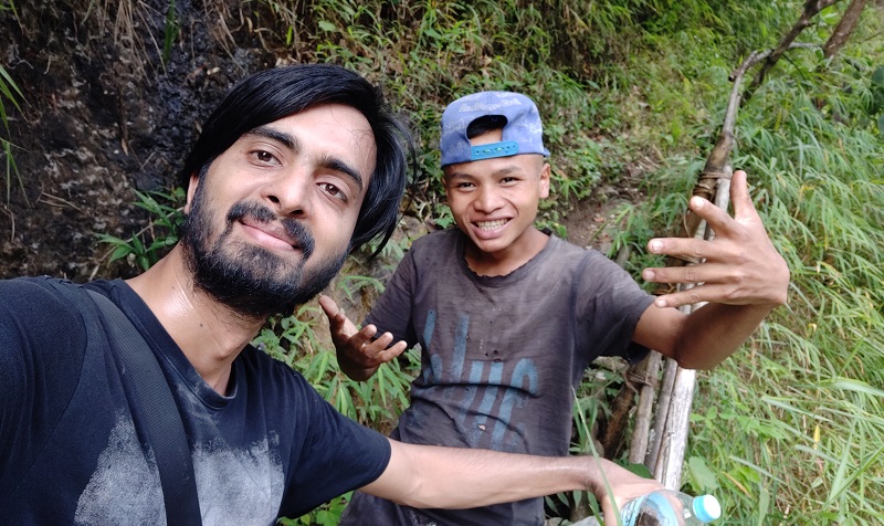
We continued our unorthodox discussion while climbing the hill and reached a point where we had to crawl and then continue the trail on the other side. On the trail, I noticed the weary bamboo was replaced by a greener one indicating the locals maintain the trek every year, ensuring it holds the weight of visitors. The uncle trekking with us looked exhausted, and his clothing changed from a T-Shirt to vest. Though I also felt humid, I engaged myself with my camera giving me less time to think about external factors. Another 45 minutes and we reached a point, which looked like a waterfall, we filled our water bottles and continued further. Finally, we reached our destination, and we had to climb the last ladder to reach the top of the hill. The final climb looked steeper, but the way ladder was constructed, it looked like a piece of cake. I went first, followed by our guide, and then the rest members followed us. After reaching the top, I was astonished by the view, and all the sweat vanished within a minute. Until now, I was clicking photos on my camera and thought of taking a few more photos on my mobile. To my surprise, I saw my phone showing network connectivity and 4G signal. I went for a video call and called my friend and showed him the view and location where I was. After the call, we all sat there and discussed the construction and creativity of the Khasi tribe. We all went for a group photo and asked our guide to click a group photo and then included him in the selfie. While we were discussing how much time would it take to return, I felt water droplets on my camera and shoulder. As we all were aware of the Meghalaya’s rain, we started returning. While returning, we all took extra precautions as the rain has made the bamboo raft slippery. We hardly walked for some 15 minutes, and the rain stopped. We all had a good laugh assuming that the stone king Mawryngkhang didn’t like us and forced us to return.
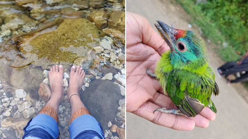
Anyways the decision to return was right as it was already 3:15, and we knew no matter how fast we walk, it will take another hour to finish the trek. Once we reached the Umrew river, we all planned to sit there and enjoyed the clean water of the river. We knew we had sufficient time, and it was our last day in Meghalaya. I removed my shoes and went into the middle of the water stream. The water was not only clean but chilling; I could see my feet and felt like doing a natural pedicure. For the first time in the entire trek, the uncle asked me to click his photo, and I obliged to it. Our guide was in a hurry and asked if we can pay him the fees as he has to go home and help his mother. Since from here, we knew the return route we paid him the 500 rupees as per the rules. Another ten minutes on the river back and then we started returning to the point from where the trek started. Once we finished our trek, we all went to the nearby shop and ordered tea. I was feeling hungry as my last meal was at the Krang Shuri waterfall six hours ago. I ordered the local rice plate with vegetables, and it looked delicious. Looking at my plate, other members also ordered the same, and we had a heavy lunch there. After finishing our meals, we all posed for a group selfie and wished everyone good luck for their future trips. I went to the place I parked my bike and started riding towards Mawkajem. I planned to reach Guwahati by night, but the plan derailed by the time I reached Mawkajem. You can read my journey ahead here.
Also Read: Bike Ride To Tamabil Check Post And Bamboo Trail Of Meghalaya
Thanks for reading, and let me know if you liked this post via comments. In case you need any help or suggestions, do let me know. You can read my North-East India Travelogue, which can help in planning a trip to North-East India.

