Places In North-East India That Lies on International Border: A Travel Guide
A few years back, I wrote an article in my blog called “Places In India That Lies On International Border.” At that time, I was a newbie in blogging and complied it by studying the International Border of India. Over time, as my blog grew, so does my knowledge about the border of India. During these years, I also made an extensive trip within India, and it helped me to understand the country from a different perspective. This year I completed a sixty days solo ride to North-East India, and it not only gave me beautiful memories but also enhanced my knowledge about India and particularly the North-East Inda. Four years back, when I wrote the article, I did my best to include all the places on the international border of India, yet after completing my ride, I knew I missed a lot of areas. Initially, I thought to extend my previous article, but once I complied all the sites, I knew I had to come up with a separate article. Therefore in this article, I will be sharing the places in North-East India that lie on the International Border of India. Of all the sites mentioned in this article, I had personally visited most of the sites, thereby allowing me to give detailed info. In case one wants to know how to reach a particular place, he/she can follow the link to my north-east India ride. I have categorized the places under each state, which would help the readers understand the area better. Throughout the article, I would also be sharing terminologies that would help in understanding the places and their location near the border. In case any additional info is required, kindly let me know via comments/mail/messages, and I would try my best to provide the information related to these places in north-east India.
Qucik Navigate:
Why The Border At North-East India Is Different From Rest
The North-East region of India is a landlocked area connected to India’s mainland vis Chicken’s Neck or commonly called the Siliguri Corridor. The Siliguri corridor is a narrow stretch of land (22 kilometers), in the Indian state of West Bengal, which connects northeastern states to the rest of India. The striking feature of the region is that it shares an international border of 5,182 kilometers with several neighboring countries while occupies only 8% of the total area of India. Around 98% of the boundary of the north-eastern states has an international border, allowing villages and towns on the proximity of the border.
A Video Listing Places In North-East India On International Border
Another reason for a different type of border is the relationship of India with its neighboring countries in the eastern part. We all know the relationship between India and Pakistan, and thus the border shared by these two countries comes under high security, allowing only a few entries and exit points. In the case of China, there are differences, but they are settled down on the table rather than on the battlefield. As the relation of India with its neighbors in the eastern part is peaceful, there are so many places on the border in the east part of India. In some areas, tourists are allowed to visit the border and sometimes allowed to cross the border.
Also Read: A Detailed Comparision Between India And Pakistan
One more reason is that tribals mostly inhabit the area, and they share cultural and religious similarities across the border. Before India appeared on the world map, the whole area was inhabited by indigenous tribes. For them, their culture was paramount compared to the nations they live in, and the government heard their demands. Post-independence, the government of India made provisions so that the tribal people in these areas don’t face problems in continuing their identity. Before listing the places, a few things needs to be mentioned, which would further help readers in understanding the complexity of the border of India in the north-east region.
Integrated Check Posts (ICP)
The Integrated Check Post (ICP) acts as a trade center for the facilitation of bilateral trade between India and its neighboring countries. The ICP’s allow the movement of goods and passengers across the border, thereby generating employment opportunities. The ICP’s have helped in boosting the economy of the state and the region where they are located.
Free Movement Regime (FMR)
The Free Movement Regime is only applicable to the India-Myanmar Border. The FMR allows tribes living along the border to travel 16 km (9.9 mi) across either side of the border without visa restrictions. There are over 250 villages with over 300,000 people living within 10 kilometers (6.2 mi) of the India-Myanmar border who frequently cross the border through formal and informal border crossings.
Land Customs Stations (LCS)
The Land Customs Stations (LCS) can be considered as mini ILP where they lack the facilities the ICP’s have yet contribute to the cross border trade. The LCS’s are identified as potential trade points and upgraded with facilities like weigh-bridge, warehousing, parking facilities, and other amenities. While the central government mostly manages the ICP’s with the assistance of security forces, the State Governments manages the development of trading facilities in the Land Customs Stations. Also, the land customs stations are not under any single authority, but there are talks of transferring them to the ministry of commerce.
Border Bazaars and Haats
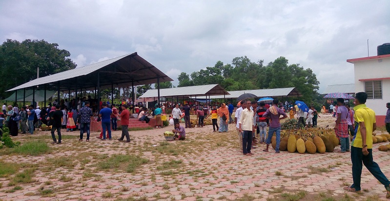
The Border Bazaars and Haats aim at promoting the well being of the people dwelling in remote areas across the International border of India. The border haats relies on the traditional system of marketing. The border haats trade the products of daily usage from both sides of the border. The bazaars are identified by the respective state government to facilitate the trade and help people living around the border to earn their livelihood.
States Added and Omitted While Compiling The List of Places on Border of India
As mentioned at the beginning of the article, I will be listing the areas in North-East India, which lies on the international border of India. I would also mention if the person can cross the border and if any permits are required or not. This article intends to cover the eight sister states meaning West Bengal would be excluded. West Bengal also forms the international border of India with Bhutan, Nepal, and Bangladesh. But West Bengal is not included in the list as it is not the part of North-East States. It means that I won’t be adding Jaigaon-Phuentsholing border as well as other areas where the town in West Bengal touches the border of India.
Places In Arunachal Pradesh That Lies on International Border of India
Arunachal Pradesh is the biggest and most sparsely populated state among all the north-eastern states. Arunachal’s vast area allows it to form a long boundary with the neighboring countries. Arunachal Pradesh forms the International border with Bhutan, China, and Myanmar. An Inner Line Permit (ILP) to enter Arunachal Pradesh, and due to the border disputes, there is a massive movement of security personnel. With these restrictions in place, yet the state is a travelers paradise, and there are few locations in Arunachal Pradesh where one can touch the International Border of India and even cross at a few other places. The places in Arunachal Pradesh situated on International Border are:
Also Read: A Complete List Of Mountain Pass In India & Himalayas
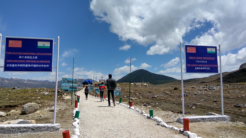
1: Bum La: Bum La lies on the international border of India and China in the Tawang district of Arunachal Pradesh. The pass lies at an elevation of 15,200 feet and is close to the town of Tawang. The town of Zemithang also lies near the border of India and China, and tourists can visit this place. Crossing the border at Bum La Pass and Zemithang is not possible, but one can visit the border. Zemithang is more than 500 kilometers from Guwahati, and the route to reach Zemithang is: Guwahati-> Kalaktang-> Bomdila-> Dirang-> Tawang-> Zemithang/ Bum La Pass.
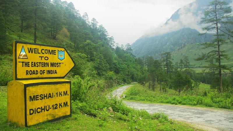
2: Kibithu: Kibithu is a town in the Anjaw district of Arunachal Pradesh. The town is one of the easternmost permanently populated cities of India and located on the LAC (line of actual control). Kibithoo served as a natural passage between Tibet and India’s North-East Frontier Tract during the British colonial period. Kibithu has an Army H.Q as the area lies nearby to the Chinese border. There is a small village called Kaho or Kahoo, which lies on the border, and tourists can visit the international border here. Crossing the border is not allowed, but one can visit the check-post as Kaho is the last point where a traveler can go. Kibithu is famous for the Battle of Walong in 1962 as well as for the reason that the Lohit River enters India at Kibithu in Arunachal Pradesh. Kibithu lies 840 kilometers from Guwahati, and to reach Kibithu, one has to follow the following route: Guwahati-> Jorhat-> Tinsukia-> Teju-> Walong-> Kibithu.
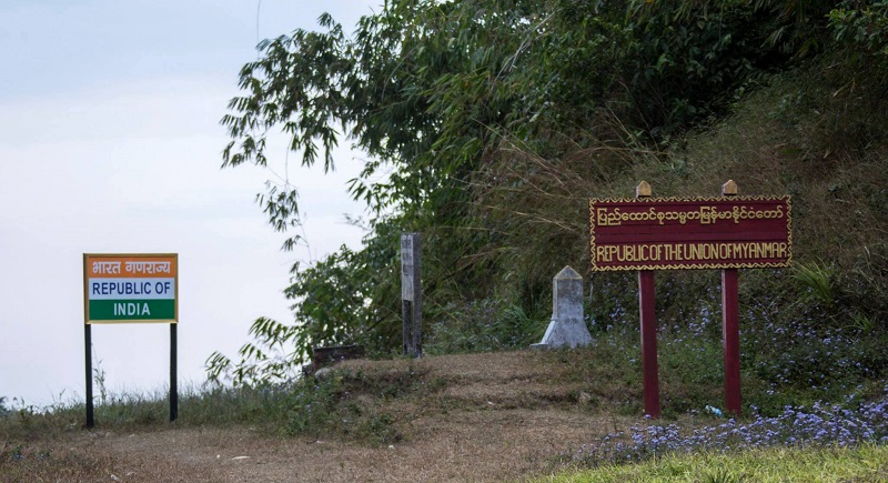
3: Pangsau Pass: The Pangsau Pass pass lies at an elevation of 3727 feet on the border of India and Myanmar. The pass, named after the nearest village of Myanmar, i.e., Pangsau, which means “Camping Place.” Tourists are allowed to cross the border and visit the Myanmar side of the border. The Pangsau Pass lies near to the famous “Lake of No Return,” which lies in Myanmar. The lake is 1.4 km in length and 0.8 km in width in its broadest part. The Indian town on the border is Nampong and connected to the pass by the famous Ledo Road, formerly called Stilwell Road. The old Stilwell Road was built during the second world war for the transportation of Allied forces in the Indo-China region. An annual festival by the name “Pangsau Pass Winter Festival” is celebrated every year where The route to reach Pangsau Pass is: Guwahati-> Jorhat-> Digboi-> Nampong-> Pangsau Pass.
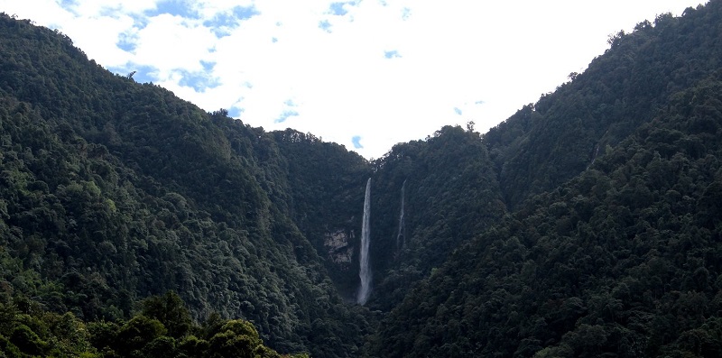
4: Bishing/Gelling: – The town of Bishing lies on the India-China International border in the Upper Siang district of Arunachal-Pradesh state. The town is sparsely populated and inhabited by the Adi Tribe. There is a road connecting Tuting to Gelling, and from Gelling, one has to do a day trek to reach Bishing. Bishing is also famous for the Bishing waterfall, and the Brahmaputra river, which is one of the important rivers of India, enters India from Bishing. Brahmaputra river is also known as Siang in Arunachal Pradesh. To reach Bishing; one has to follow the following route: Guwahati-> Jorhat-> Dibrugarh-> Pasighat-> Tuting-> Gelling-> Bishing.
Places In Assam That Lies on International Border of India
Assam is the most important states amount all the north-east India states. Assam forms the International Border of India with Bhutan and Bangladesh. Assam touches Bhutan on its western side and Bangladesh in the southern and eastern side. The places in Assam which lie on the International border and where tourist can visit border are:
1: Gelephu: Gelephu is a town in Bhutan on the India-Bhutan International Border. The nearby district on India’s side is the Udalguri district in Assam. Tourists can cross the border from the India side and visit Bhutan, but for this, they need to get a proper permit. The route to reach Gelephu is : Guwahati-> Nalbari-> Bongaigaon-> Modati-> Gelephu.
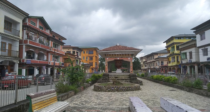
2: Samdrup Jongkhar: It is another town on the Bhutan side sharing border with India. Samdrup Jongkhar is considered one of the oldest towns in Bhutan, and Indians can cross the border and visit the nearby area. For an official entry in Bhutan, they need to arrange the proper travel documents. The route to reach Samdrup Jongkhar is Guwahati-> Rangia-> Indo-Bhutan Gate at Samdrup Jongkhar.
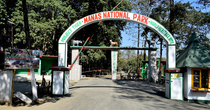
3: Mathanguri-> Mathanguri is a small border check-post on the India-Bhutan Border in Manas National Park. If you are traveling to Manas National Park, you can visit this check post, which is some 25 kilometers from the entrance gate of Manas. The Manas National Park continues to Bhutan, where it is called Royal Manas National Park. One can cross the border at Mathanguri and enter Bhutan with a proper document. The route to reach Mathanguri Checkpost is: Guwahati-> Nalbari-> Manas National Park-> Mathanguri.
4: Mankachar: Mankachar is a town in the Dhubri district of Assam and one of the far western points of the state of Assam. Mankachar forms the International Border between India and Bangladesh, and Rowmari is a town on the Bangladesh side of the border. Mankachar not only forms the border with Bangladesh, but it also forms the border with the state of Meghalaya. Mankachar is similar to the town of Bhairabkunda, where two states and one country meets. The route to reach Manlachar is Guwahati-> Krishnai-> Tura-> Mankachar.
5: Karimganj: Karimganj is a town in the Karimganj district of Assam. The town is located on the border of India and Bangladesh, and its counterpart in Bangladesh is Sheola. The government of India has constructed an Integrated Checkpost called Sutarkandi Integrated Check Post. Karimganj is famous for border trade, and import-export business worth crores of rupees is carried out through the custom trade point at Dakbangla Ghat at Sutarkandi Custom Station. The route to reach Sutarkandi is: Guwahati-> Umiam-> Jowai-> Sutarkandi.
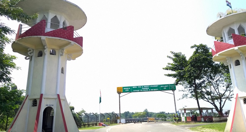
6: Bhairabkunda: Bhairabkunda lies on the Border of India and Bhutan in the Udalguri district of Assam. It is situated on the border of Bhutan and Arunachal Pradesh, near the Bhutanese town of Daifam. The route to reach Bhairabkunda is Guwahati-> Mangaldoi-> Rowta-> Bhairabkunda.
Places In Tripura That Lies on International Border of India
Tripura is another north-east India state which forms the international border of India. Tripura is one of the smallest states in India. Still, due to the border shared with Bangladesh, there are a few points where tourists can visit the India-Bangladesh International Border. Most of the border between India and Bangladesh is separated with the help of barbed wire, yet at a few points, one can visit the Border of India. The locations where tourists can visit the international Border in Tripura are:
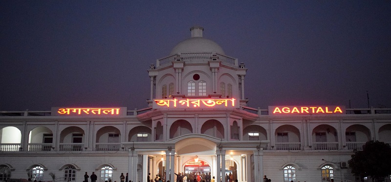
1: Agartala: Agartala is the capital of Tripura, and the capital city lies on the border of India and Bangladesh. The Agartala-Akhaura Integrated Checkpost acts as the gateway for both the countries. The integrated check-post lies four kilometers from the city and can be visited ay time of the day. A small Beating Retreat Border Ceremony is organized by both the countries similar to the one held at Attari-Wagah Border of India and Pakistan.
2: Belonia: Belonia is a town in the South Tripura district of Tripura and serves as its headquarters. Belonia lies 90 kilometers from the state capital Agartala via Udaipur. Parshuram lies on the Bangladesh side. Before the partition of India, there was regular railway connectivity between these two towns. The rail route operated from Santirbazar in India to Feni in Bangladesh but later stopped amid conflicts. Now the Government of India is planning to start the railway line and establish an integrated check-post. The route to Belonia is Agartala->Udaipur-> Belonia.
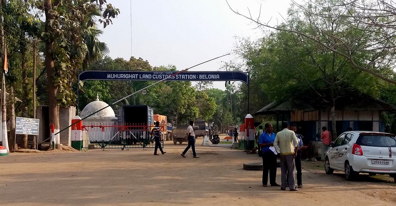
3: Sabroom: Sabroom is a town in the South Tripura district in the Indian state of Tripura. The city lies on the banks of the Feni river, which acts as a natural border between India and Bangladesh. The town of Ramgarh lies on the Bangladesh side. Sabroom lies on the southern end of Tripura, and the state capital Agartala is around 130Km. National Highway 8 connects the capital from Sabroom. The route to reach Sabroom is Agartala-> Udaipur-> Sabroom.
There are few more places in Tripura where tourists can reach close to the international border of India-Bangladesh. These places include Kamalasagar, Khowai, Kamalpur, and Kailashahar. The Comilla View Tourist Lodge by the Tripura government lies on the border. The famous Kasba Kali Temple in Kamalasagar in Sepahijala District also lies near the border of India-Bangladesh.
Places In Mizoram That Lies on International Border of India
Mizoram is the northeastern state of India, and it shares a border of 772 Kilometers with Bangladesh and Myanmar. Most of the Mizoram is covered by forest, and around 90% of the state area is under forest cover. The hills and the forest makes the construction of roads a daunting task, yet there are roads in Mizoram where you can touch the international border of India. There are few points in Mizoram where tourists can cross the border of India (FMR), and local people have continuously used those places for centuries. The Indian government is also opening up a few more points to boost trade in the region. The places were one can visit Border in Mizoram are:
1: Zokthawar: Zokthawar is a border town in the Champhai district of Mizoram. The town lies on the International border of India-Myanmar, where Harhva River forms the natural border between India and Myanmar. There is a bridge on the river in Zokthawar, and after crossing the bridge, Myanmar starts. Indian citizens are allowed to cross the border and visit the nearby town. Khawmawi is a village in Myanmar, which lies next to Zokhawthar in Mizoram, and the famous Rih-Dil Lake lies four kilometers from the border in Myanmar. The lake is often visited by tourists from India and local Mizo people. The route to reach Zokthawar is Aizawl-> Keifang-> Kawlkulh-> Champhai -> Zokthawar.
2: Hnahlan: The town of Hnahlan also lies in the Champhai district of Mizoram and shares the border with Mizoram. The city adjacent to Hnahlan on Myanmar side is Darkhai. Tuimui road acts as a common path for both countries. The tourist does not often visit Hnahlan, and they prefer to visit Champhai and return to Aizwal, but Hnahlan is also a must-visit place in Mizoram. There is a tourist guest house by the Mizoram government for accommodation. The famous Murlen National Park also lies near the town of Hnahlan. The route to reach Hnahlan is: Aizawl-> Keifang-> Kawlkulh-> Champhai -> Hnahlan.
3: Vaphai: Vaphai is another town in the Champhai district of Mizoram, and the town is close to the border of Myanmar. The town on Myanmar side is known as Leilet. The original name of Vaphai was “Ivaphai,” which means “Plains of the river Iva,” referring to its original location in the river valley slightly west of its present location. The town is situated at an average altitude of 5,686 feet (1,733 m) above sea level, and the nearest big town is Khawbung and North Vanlaiphai. The distance of Vaphai from the state capital Aizawl is around 88 km. The area is also famous for the rock carving of the region, which symbolizes the rich Mizo culture.
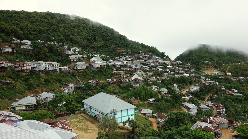
There are two more places in Mizoram where the international border is close to the town/city of India. These are Tlabung in Lunglei district and Niawhtlang in Saiha district of Mizoram. In the case of Tlabung, the government of India has opened an Integrated check post for better development of the region via trade.
Places In Manipur That Lies on International Border of India
Manipur lies between Mizoram in the south and Nagaland in the north and the west; Assam surrounds it. Manipur forms the international border of India on the eastern side with Myanmar, and the two countries share a perimeter of 400 Kilometers in length. Chandel, Churachandpur, and Ukhrul are the districts in Manipur sharing border with Myanmar. The Places in Manipur on the International Border are:
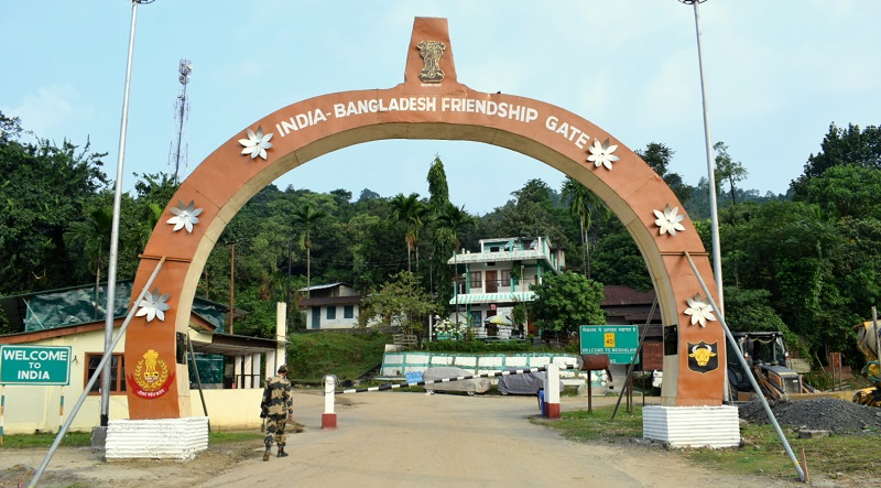
1: Moreh: Probably the most famous border crossing in north-east India. Moreh is known as the gateway to south-east Asia and one of the biggest commercial center in north-east India. Moreh lies in the Chandel district of Manipur and its counterpart town in Myanmar is Tamu. Moreh lies 110 kilometers from the state capital Imphal and easily accessible via road. Moreh is one of the crucial Integrated check-post in north-east India, and the government of India has constructed the Indo-Myanmar Friendship gate to commemorate the India-Myanmar relations. Tourists are allowed to cross the border and visit the nearby town. The route to reach Moreh is Imphal-> Thoubal-> Tengnoupal- Moreh.
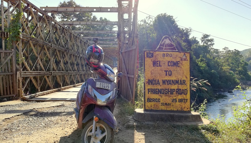
2: Behiang– Behiang is a town in the Churachandpur district of Manipur. It is a small town with roughly a population of 1000. The town Khenman lies on the border, and the city of Chikha lies on Myanmar’s side. Both border towns are connected vis Tedim Road running from India to Myanmar. There is already a small market in Behiang town, but now the government of India has approved an Integrated check post for better trade facilitation. Behiang is 130km from the state capital and can be reached via the following route: Imphal-> Moirang-> Churachandpur-> Singngat-> Behiang.
Places In Nagaland That Lies on International Border of India
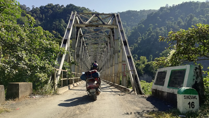
Nagaland is another state in the north-eastern side of India sharing the border with Manipur in the south, Assam in West, and Arunachal Pradesh in the north. Nagaland shares a 215-kilometer long border with Myanmar on the eastern side. The Naga hills form a natural border between India and Myanmar. Still, there are few points in Nagaland where tourists can visit the international border similar to other north-eastern states. Places in Nagaland where one can visit the international border of India-Myanmar are:
1: Longwa– Longwa is a town in the Mon district of Nagaland. The town lies 40 kilometers from the district headquarters and 370 kilometers from the state capital Kohima. The Mon district is home to is the home of the Konyak Nagas, and so is the town of Longwa. Longwa is famous for the home of the village chief, Angh, as half of the Angh’s house falls within Indian territory, whereas the other half lies under Myanmar control. The town of Lahe lies on the Myanmar side, which is 60 km from Longwa. Tourists can visit the nearby village of Myanmar by crossing the border. The route to reach Longwa is: Kohima-> Wokha-> Mokokchung-> Tuli-> Mon -> Longwa. Since the road in Nagaland side is not so good the alternate route is: Kohima-> Dimapur-> Golaghat-> Sivasagar-> Tizit-> Mon-> Longwa.
There are few more places in Nagaland situated on the international border, but they are mostly small markets and villages. Moreover, the mountainous terrain and lack of proper roads make it even more difficult for tourists to venture into those areas. Few places which are on the international border are Pangsha in Nagaland and Lahe in Myanmar and Old Thewati village in Nagaland, India, and Pansat in Myanmar.
Places In Meghalaya That Lies on International Border of India
Meghalaya lies in the south of Assam and shares the border with Bangladesh on its southern side. Meghalaya means “Adobe of Cloud,” and the high rainfall received by states makes it true home to cloud. Meghalaya forms a 450-kilometer long border with Bangladesh. In most of the length, mountains form a natural border between Meghalaya and Bangladesh. Places in Meghalaya which lies on the International border of India are:
1: Dawki: Dawki is a town in the West Jaintia Hills district of Meghalaya. The town lies on the border of India-Bangladesh, and there is an integrated check-post for the fast movement of import-export. The town on the Bangladesh side is Tamabil and India. Dawki is a popular tourist destination for boating, and clear water of Umngot plays a vital role in promoting touring. Dawki lies 90 kilometers from the state capital Shillong and can be reached via the following route: Shillong-> Laitkynsew-> Pynursla-> Dawki.
Also Read: Bike Ride To Tamabil Check Post And Dawki
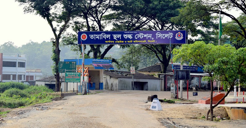
Apart from Dawki, Meghalaya has many more places which touch the International Border of India. These places are mostly local markets where citizens from both countries come to purchase the daily use of goods. The government of India has also marked few places among them and planning to upgrade it to “Land Custom Stations or LCS.” These places also lie on the border, and travelers can visit these places without any issues. These places include:
2. Balat: Balat is a small town on India-Bangladesh border in the state of Meghalaya. The town lies in the East Khasi District of Meghalaya, and the town of Dalora lies in Bangladesh. The town of Balat can is accessible from Cherrapunjee and Mawsynram. Balat had played a vital role in the Bangladesh Liberation War, and most of the soldiers of Mukti Bahini were trained here by Indian Defense forces. Balat lies 100 kilometers from the state capital Shillong and can be reached via the following route: Shillong-> Nonglwai-> Mawsynram-> Balat.
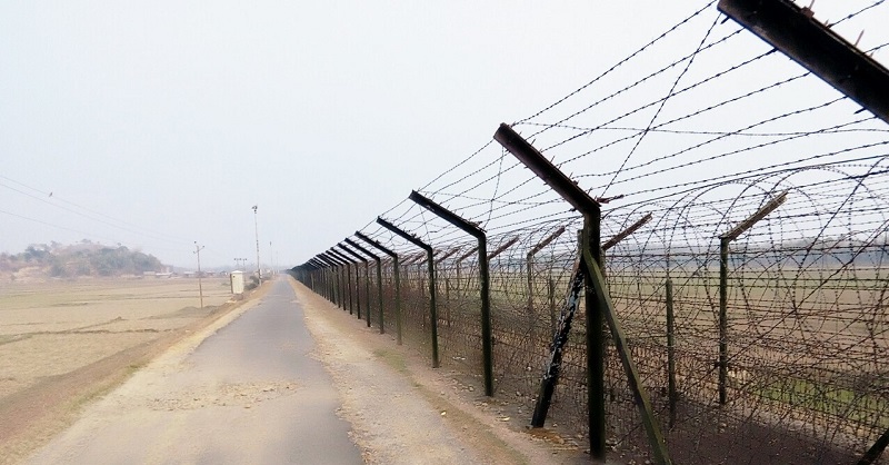
3. Kalaichar: Kalaichar is another town on India-Bangladesh border in Meghalaya. Kalaichar town lies in West Garo Hills district and near to the town of Mankachar. It has a traditional border haat (market) along the Indo-Bangladesh border, which was recently reopened after four decades of the shutdown. The town opposite to Kalaichar is Baliamari in Kurigram District of Bangladesh. Kalaichar is 380 kilometers from the state capital and can be reached via Shillong-> Guwahati-> Krishnai-> Tura-> Kalaichar.
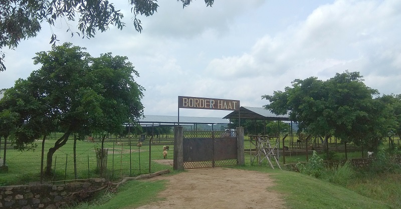
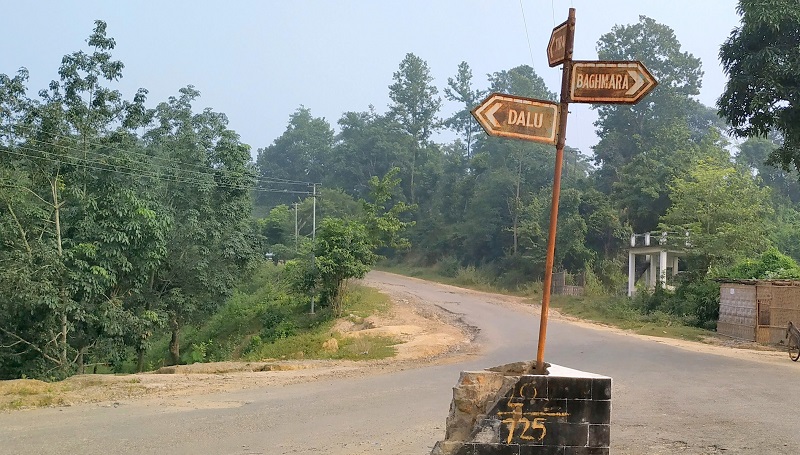
4. Bhagmara: Baghmara is a town in the South Garo Hills district of Meghalaya in India. The town of Baghmara lies nearby to the borer India-Bangladesh, and the city of Durgapur lies on the Bangladesh side. The place is bordered by Bangladesh and is about 113 km from Tura. The famous Siju Cave and Balphakram National Park are 45 km 66 km from Baghmara. The town has a historical sea trading connection with Bangladesh, and the river Someshwari river flows here from India to Bangladesh. The town has a Pitcher plant sanctuary located at the Dilsa Hill colony of Baghmara. Baghmara can be reached via following route: Shillong-> Mairang-> Nongstoin-> Nongjri-> Baghmara.
Apart from Kalaichair, Baghmara, and Balat, there are four more Border Haats under consideration of the Government of India. They are:
- Bholaganj (East Khasi Hills, Meghalaya) – Bholaganj (Companiganj, Sylhet)
- Nalikata (South West Khasi Hills, Meghalaya) – Saydabad (Tahirpur, Sunamganj)
- Shibbari (South Garo Hills, Meghalaya) – Bhulyapara
- Ryngku (East Khasi Hills, Meghalaya) – Bagan Bari (Duara Bazar, Sunamganj).
Places In Sikkim That Lies on International Border of India
Sikkim is another North-Eastern State of India, and together with the other seven north-eastern states, it forms the eight sisters. The state is the second least populated state in India and also the second smallest state in terms of area. The state of West Bengal surrounds Sikkim in the south, Nepal in the west, Bhutan in east, and China in the north. Since the state shares its border with three countries in three directions, many places in the state lie on the International border. Though the rough terrain and Himalayan Range prohibit people from living in remote areas, yet the state has few points where tourists can visit the international border.
Moreover, growing tourism has forced the state/central government to identify more such places and develop them as tourist centers. The sites in Sikkim which lie on International Border are:
1. Gurudongmar Lake: Gurudongmar Lake is a high altitude lake in the North Sikkim district of Sikkim. The lake lies at an altitude of 17,800 ft (5,430 m), and the India-China Border is around 5 kilometers from the lake. The lake is sacred to Hindus, Sikhs, and Buddhists and lies 180 Kilometer from the state capital Gangtok. The following route can reach Gurudongmar Lake: Gangtok-> Mangan-> Chungthang-> Lachen-> Gurudongmar Lake.
Also Read: A Bike Ride To Two Biggest Lakes of Ladakh
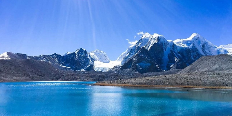
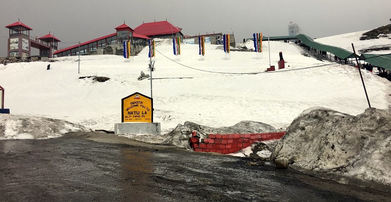
2. Nathu La Pass: Nathu La is a high mountain pass on the India-China International border in Sikkim. Two more passes, i.e., Cho La (4,593 m (15,069 ft)) and Jelep La (4,270 m 14,009 ft) also lies on the international border and are close to Nathu La Pass. Nathu La Pass is at an elevation of 4,310 m (14,140 ft) above sea level and served as the path of the old silk route. Nathu La is also one of the five Border Personnel Meeting Points between the Indian Army and the People’s Liberation Army of China. Nathu La Pass lies 53 kilometers from the state capital and can be reached after a two-hour ride. Tourists can cross the border and visit the China side for a few hundred meters after taking appropriate permission. The place is also famous for Baba Harbhajan Singh Temple and Sarathang Lake.
3. Katao: Katao is a town situated in the North Sikkim district of Sikkim, and it is another town in Sikkim near to the international border of India and China. Katao lies at an elevation of 15000 feet above the sea level and 130 kilometers from the state capital Gangtok. The town is famous for a panoramic view of the snow-capped peak of Himalaya and sightseeing of Mount Katao. It is not easy for tourists to visit Katao as its proximity to the Chinese border, and additional permits are required from the army to visit this place. The road goes nearby to the border but not allowed to cross the border. The nearest town to Katao is Lachung. The route to reach Katao is Gangtok-> Dikchu-> Mangan-> Lachung-> Katao.
I have tried my best to include all the places that lie on the International Border of India in the north-east region. I would continue updating this list as the government is continuously identifying and upgrading sites to boost the economy of the area. In case I have missed any place, do let me know, and I would add them to expand this list.

