Day Twelve In North-East India: Ride From Haflong To Silchar
The best thing about traveling is that it amazes with every passing moment. While on one day, you might witness remarkable natural beauty, you might encounter the opposite on another day. In Assam, it was a similar day for me. Yesterday I rode on the Lumding-Maibang-Haflong Highway, which was the best in my entire North-East India ride. Today I rode on the Haflong-Silchar Road, which turned out to be the worst in the region. My plan for today was to reach Silchar after exploring the Haflong town. I assumed I would take 2-3 hours to reach Silchar as Silchar is only 100 kilometers from Haflong. My opinion was on the fact that the National Highway 27 is in excellent condition, and I rode 300 kilometers on the same highway yesterday. Upon checking Google Maps, it suggested more than five hours, and I knew something was not right. I started my ride from Haflong at 12 in the noon and reached Silchar by 7:00 PM. I took 7 hours to cover a mere distance of 100 kilometers, and anyone can guess and how bad the roads would have been. Therefore in this article, I would be narrating my ride from Haflong to Silchar. I would also explain the condition of the road from Haflong to Silchar, also known as the National Highway 27. Throughout this travelogue, I would share the main towns and places en route, which might help people planning to travel to the southern Assam.
Qucik Navigate:
Why Silchar Is Important In Itinerary of North-East India
Also Read: Bike Ride From Kaziranga To Haflong
Anyone planning to visit north-east India knows that Silchar serves as the center point of the region. Almost all the big towns of north-east Indian state lies at an equidistance from Silchar. Due to its unique location, Silchar acts as a focal point from where travelers can go to any state in North-East India. The distance of major north-east Indian cities from Silchar via road is:
- Silchar-Guwahati (Assam) ->310 Kilometers
- Silchar-Agartala (Tripura) -> 290 Kilometers
- Silchar-Aizwal (Mizoram) -> 180 Kilometers
- Silchar-Imphal (Manipur) -> 260 Kilometers
- Silchar-Dimapur (Nagaland) -> 300 Kilometers
- Silchar- Shillong (Meghalaya) -> 210 Kilometers
The importance of Silchar is not only because of its distance from the major states of north-east India but also because it is one of the biggest city in North-East India. If we consider the population as a parameter, Silchar is the second biggest city in Assam after Guwahati. The city is the seventh-largest city in north-east India and a major tourist hub. From automobile workshops to hotels, everything thing is readily available in Silchar, making it a must-stop for any traveler exploring north-east India.
Also Read: A Complete List of Places To Visit In Guwahati
The Route I Followed on Haflong To Silchar Bike Ride
Also Read: A Guide To Visit Places In Haflong
There is only one route connecting Silchar to Haflong, which is the National Highway 27. The National Highway 27 is one of the vital highways in India and the second-longest Highway in India after National Highway 44. The highway starts at Porbandar in Gujrat and terminates at Silchar in Assam. The road from Haflong to Silchar is the last 100 kilometers of this highway, and it passes through the dense forest of Dimsa Hills. As Silchar lies in the plains of Barak River Valley, the last 30-40 kilometers of this Highway is in good condition. The real challenge is from Haflong to Balichara (70 kilometers), which was a hell of a ride. The route I followed during my ride from Haflong to Silchar was: Haflong-> Jatinga Lampur-> Mailongdisa-> Harangajao-> Damchara-> Balichara -> Silchar.
Condition of Haflong-Silchar Highway or National Highway 27
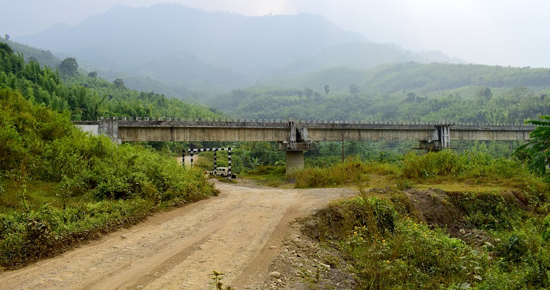
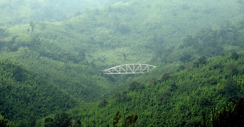
The road from Haflong to Silchar is in horrible shape. In almost 80% of the stretch, there is no road at all, and the route comprises of mud, sand, and rock boulders. The road from Haflong to Ethnic Village is a narrow and single-lane road, but the condition is still better. The poor stretch starts after Ethnic Village and continues till the Balichara. I have ridden on some of the worst and challenging roads in India like Sach Pass and Pangong Tso to Tso Moriri. The Haflong-Silchar road gives fair competition to the above routes in terms of irregular patches. While in the case of my Ladakh Ride, the road was a mix of good and bad spots, here there was no good patch. Despite the horrible road, the stretch offers unparalleled beauty. The Jatinga River runs parallel to the Haflong-Silchar Highway. The railway line from Haflong to Silchar also runs parallel to this highway, and while the journey via road is a nightmare, it is opposite in the case of railways.
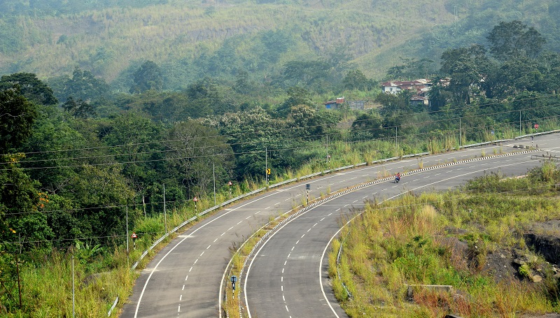
Although construction of the highway is going on but looking at the terrain and challenges, I assumed it would take further three to four years to complete this highway. After Harangajao, the condition worsens even further, and there is no harm in saying that there is no road at all. The path is made up of big rock boulders and sand. No public transport ply on this route and only means of transportation is the shared sumo service between Haflong and Silchar. The newly constructed railway line acts as a lifeline and saves locals from the pain of traveling on this road. At Balichara, the hills end and the condition of the road improves, and the single-lane transforms into a four-lane highway. From Balichara, Silchar is around 30 kilometers, and the road is in good shape.
My Ride On Haflong Silchar Highway
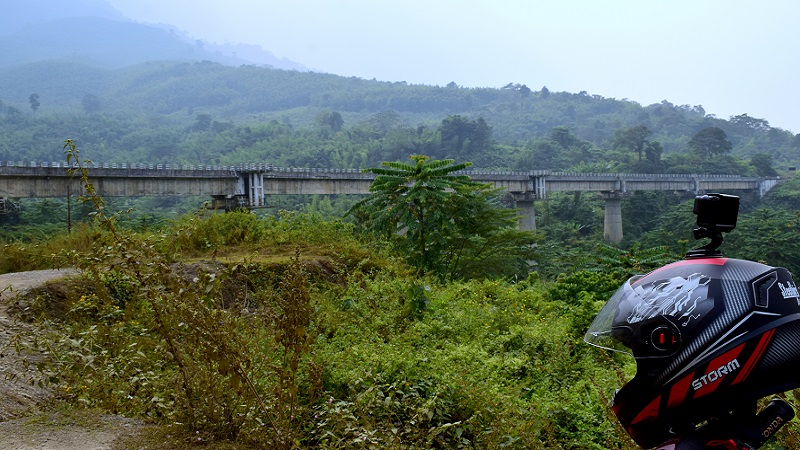
By afternoon, I had completed most of the places I intended to visit in Haflong, and I was ready to start my journey for Silchar. The last two points to visit in Haflong, i.e., Jatinga and Ethnic Village, were en route, and therefore I planned to cover them while riding. I took another forty-five minute to visit both the Jatinga Bird Tower and Ethnic Village. With no more place to see, it was time to continue my ride for Silchar. From Haflong, I rode on an average single laned road till Ethnic Village. The road looked like a typical road in the Indian villages, and nowhere gave an impression of National Highway. Although the condition of the highway started deteriorating from Mahur when I rode from Kaziranga National Park to Haflong. I saw an improvement in the Haflong and hoped the highway would continue to be the same. But today, as soon as I crossed the Haflong town, the road started deteriorating, and I was riding on a path made up of sand and rocks. The Silchar-Haflong highway passes through the Dimsa Hills, and while riding, I can see the dense forest on one side and paddy fields on another. The newly constructed Silchar-Hafong Rail route runs parallel to this highway, intersecting with road numerous times. Ten minutes of the ride, and I saw the first railway station on this highway, which was the Jatinga Lampur Railway Station. While riding on this highway, I crossed many railway stations like Harangajao, Ditokcherra, Bandarkhal, Damchara. Situated 2156 feet above sea level, the Jatinga Railway is the highest railway station on this route. I decided to take a small break to click a few pictures of the railway station.
After taking sufficient photos of the railway station and the surrounding valley, I continued my ride further and reached Harangajao Railway Station. There was no improvement in the condition of the road, and it deteriorated further. Initially, I tried making the video of my ride, but the bumpy ride forced me to stop the recording and focus on balancing my scooter. Like the Jatinga Railway station, the Harangajao railway station is also newly built while upgrading the Old Silchar Haflong Rail route. The newly constructed railway station looked beautiful, but as soon as I hit the road, the same nightmare resumed. It seemed like there is no end to this bad stretch of road. I noticed many Sumos plying on this route, and I was able to experience the suffering of commuting on this road. While the road mostly comprised of big and small rock boulders till Harangajao. After Harangajao, it mainly included mud and sand. Though the sand brought relief when compared with rock, the same is not valid in the monsoon season. This part of the country receives maximum rainfall in India, and one can understand the situation of the road after a fresh rain.
Due to the dilapidated condition of the highway, there is hardly any shop, and the possibility of finding one is maximum nearby the railway station. The highway and the railway route intersects with each other numerous times with stations situated adjacent to the road. After a fifteen minutes ride, I decided to take a small tea break at a small shop near Narainpur. While ordering my tea, I asked the lady at the shop which railway station it is to which replied with a name I didn’t understand. Later I checked on the phone, and the name of the station was Ditokcherra. The shop resembled like the shop I used to see in my village, a few Parle G Biscuit Packets, daily utensils, and a few more daily household items. When I enquired from where she get these items, she replied that they go to Silchar to purchase these items. The local people prefer railways for transportation as sumo charges are high and are used only in the case of an emergency. The small margin on these items is the only source of income for these women. Looking at the condition of the highway, I assumed people would hardly travel on this route, or in case they do; there is a slight possibility they would stop at the shop around the highway. Yet, these ladies spend their entire day in the shop and spend their free day in reinforcing their shop. After paying ten rupees for the tea and biscuit, I resumed my ride as it was already 3:00 PM, and I knew that the bad stretch is not yet over.
After riding for another thirty minutes, I noticed a long queue of vehicles. I was skeptical of such a long line of vehicles in a remote area like this. Upon checking, I learned that a truck got stuck in the mud, and now people were trying to pull the truck out. I crossed the entire jam portion by driving on the side path left by other vehicles. Though the road was narrow and the standing vehicles had occupied the full width of the way, I managed to cross the stretch, all thanks to riding a two-wheeler. Once passed, I continued riding and noticed an increase in the forest cover on both sides of the road. If earlier the terrain caused the construction of the highway impossible, now it looked like the dense forest is playing the same role. The Jatinga River flowing parallel to the road became invisible under the thick forest cover, so does the railway line. Anyways, I continued my ride, and after riding for mear ten kilometers, I noticed road widening work being carried out.
I also saw a few engineers, along with other workers working on the project. I parked my bike at the roadside and inquired from where I can expect this bad stretch to end and the average road to start. He told that the bad patch is for further 10 kilometers, and after that, the condition of the road will start improving. Since my mobile phone has no network, I was unaware of the area and asked for the name of the place. He informed me that the place is called Damchara. The engineer was of my age, and while I worked in the metro cities of India, he was working in one of the remotest parts of India. During our conversation, he informed me that he is from West Bengal, and after completing his Civil Engineering, joined the National Highway Authority of India as a Graduate Engineer. I also enquired about the accommodation facility, to which he responded that they have makeshift houses provided by N.H.A.I. He was happy with the facilities provided by his organization and complained only about the remoteness and no availability of the Internet. After finishing our conversation, I started riding for Silchar as I had still plenty of distance to cover before sunsets.
By the time I started riding again, it was 4:30 PM, and Silchar was still 40 kilometers to go. As the NHAI engineer stated, the condition of the road began improving, and I noticed the muddy road replaced by tarmac. A further five kilometers ride and the single lane road transformed into the four-lane highway. I knew that the hard part of today’s journey is over and therefore decided to take a final tea break. The roadside shops in these remote areas of India have little to offer, and while I was riding an empty stomach since the afternoon, there was hardly anything substantial to order. The best option was tea, and I decided to order a tea and some local snacks. Upon checking my phone, it showed internet connectivity, which was a significant relief as I had to book a hotel once I reached Silchar. Once I crossed the hills, my ride to Silchar was smooth, and I took another hour to reach Silchar City.
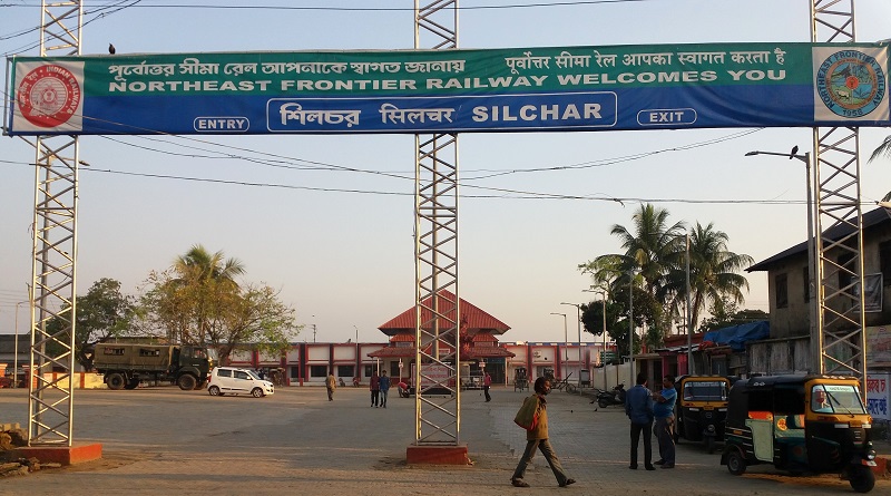
As I entered the city, I was greeted by traffic and chaos, which lacked in the last five days of my journey. Initially, I tried finding a hotel near Silchar Railway Station but later decided to find a better room in the nearby area. I booked a hotel in the primary market of Silchar and concluded today’s ride. From my riding experience, I can say that the Haflong-Silhcar Highway is the worst in North-East India. During my 60 days ride in North-East, I rode on some of the worst roads of the region like Champhai-Zokhawthar Road, Imphal-Kohima, and Sivasagar to Longwa. Yet if I compare my rides, I will say the Haflong-Silchar is the worst one. Though the construction is going on, however, it won’t be wrong in saying that it would take a minimum of 3-4 years for the road to get operational. I stayed in Silchar for the next two days as I was exhausted by two long rides. From Silchar, I was in a dilemma as I had to choose between Mizoram and Tripura. Anyways I had two days to decided which state to go next, and you can find which state I opted for in my next article.