A Ride On Lumding-Maibang-Haflong Highway In Assam: The Best Highway In North-East India
After spending two enjoyable and memorable days at the Kaziranga National Park, it was my turn to explore other areas of Assam. If you have read my article on planning my trip to North-East India, you know that initially, I planned to enter Nagaland from Kaziranga, covering Jorhat and Sivasagar en route. I had to modify my plan due to the Hornbill Festival in Nagaland, which was starting from 1st December. Now I planned to visit Nagaland in my last leg of the journey and decided to enter Mizoram and Tripura via exploring south of Assam. To enter Mizoram or Tripura, the biggest city en route is Silchar, and my next task was to reach there. Upon reaching Silchar, I had to decide whether I should go for Mizoram or Tripura. From Kohora, Silchar is 400 Kilometers, and Google Maps showed 11 hours to cover the distance. As I was riding a scooter, not a motorcycle, covering 400 kilometers in a day was a mammoth task. Also, I intended to visit Haflong, which is famous as the Only Hill Station in Assam. Therefore, I decided to reach Silchar in two days. On day one, I planned to ride from Kaziranga National Park to Haflong, and on day two from Haflong to Silchar. This way, I would be able to cover Haflong without giving much stress to my body or vehicle I was riding. Once I started riding from Kaziranga to Silchar, to my surprise, I rode on one the best highway I encountered throughout my 60 days ride in North-East India. Especially the road from Lumding to Maibang was excellent and remained the best stretch during my entire north-east ride. Therefore in this article, I will be narrating my journey from Kaziranga National Park to Haflong in Assam. I would be describing my ride on Lumding-Maibang-Haflong Highway, the condition of the road from Lumding to Haflong. I would also be explaining why a bike ride on Lumding-Maibang-Haflong Highway is a unique experience, and travelers should try riding on this highway.
Qucik Navigate:
Bidding Farewell To Kaziranga National Prak
Also Read: Bike Ride To Kaziranga National Park In Assam
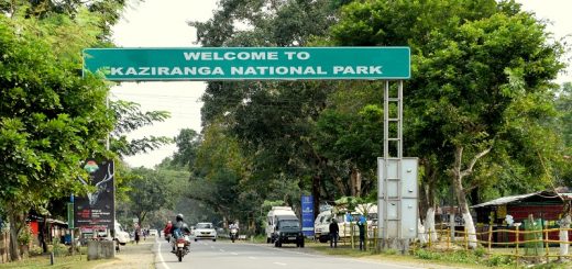
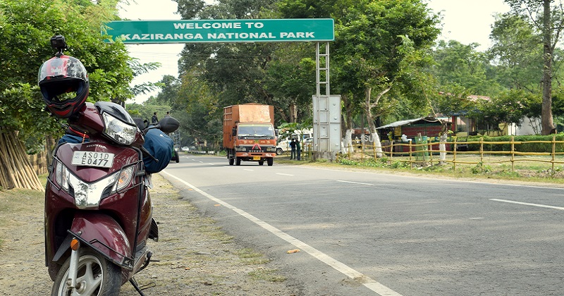
My stay in Kaziranga National Park was memorable, and with three safari rides in Eastern and Western Range, I had toured most of the park, excluding the Eastern Range. The Eastern Range, also known as the Agoratoli Range, is famous for bird watching. I would have visited the range had I continued with my earlier plan. After I decided to visit the Agoratoli range while returning from Nagaland, there was nothing more for me to do in Kaziranga National Park. It was time to say farewell to one of the most famous National Park of North-East India. After finishing the check-out formalities, I packed my backpack on scooty and clicked the last photo of the board with my scooty in the frame. I also went to a few local shops selling souvenirs and checked their prices. The price looked reasonable, but I was not in the state to buy as I had to roam in the region for many more days, and carrying a gift doesn’t look like a brilliant idea. By 9 in the morning, I left the Kaziranga National Park, and my target was to reach Haflong by evening, thereby riding more than 300 kilometers.
The Route I Followed While Riding On Lumding-Maibang-Haflong Highway
Also Read: Bike Ride From Pangons Tso To Tso Moriri Lake In Ladakh
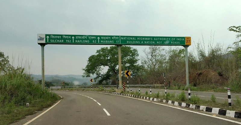
The route I followed was similar to the headline above. The Route I followed: Kohora-> Kaliabor-> Nagaon-> Lanka-> Lumding-> Maibang-> Mahur-> Haflong. The ride from Kohora to Nagaon was similar to the one I had while riding for Kaziranga. I rode on the single lane Animal Corridor of the Kaziranga National Park. I had already clicked a lot of pictures of this highway, and therefore, I continued riding without taking any break. I took three hours and reached the roundabout at Nagaon. From here, the first exit leads to Lumding and goes up to Sichar while the second exit leads to Guwahati. Upon reaching Nagaon, I thought of taking a small tea break as I was continuously riding from the last three hours. I parked my scooty at a small tea shop, ordered tea decided to get an idea about Haflong and road status. I went to an Innova car driver and enquired the same. He gave a strange look and asked why I am planning to go there? He said there is nothing in Haflong to see, and the area is not safe for tourists. When I asked the reason, he said that the area is prone to militancy and not at all safe to drive during the night.
Video Of My Ride On Lumding-Maibang-Haflong Highway
Now, it was a real shocker to me, and I remember the truck driver at Kaziranga, giving me a similar suggestion. I told him that I plan to go to Silchar, and as of now, the Haflong route is the only option I have. The car driver still said there is no use of going to Haflong, and it is better to visit some other places. It was a do and die situation for me, and I decided to enter at Haflong either during daylight or avoid going Haflong and stay at Maibang. I was not sure if I will get any accommodation in Maibang, so keeping my fingers crossed and without wasting any time, I started riding for the Haflong.
My Ride On The Lanka-Lumding Stretch of The Highway
I started from Nagaon around 12:30 in the afternoon, and the next big town in my route was Lanka. Lanka is a town in the Hojai District of Assam and lies 60 kilometers from Nagaon. From Nagaon, the road is four-laned and well constructed, and I loved riding my scooty on it. The National Highway 27 connects the southern Assam with the rest of the state, and it the second-longest highway in India. The highway runs from Porbandar in Gujrat and terminates at Silchar in Assam and is 3,507 km (2,179 mi) long. I took one hour and crossed Lanka. Upon crossing Lanka, the roadside population started declining only to be replaced by dense forest cover. I got an idea that now I have entered into the hilly area of Assam, and my next target was reaching the Lumding town.
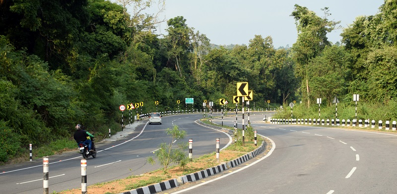
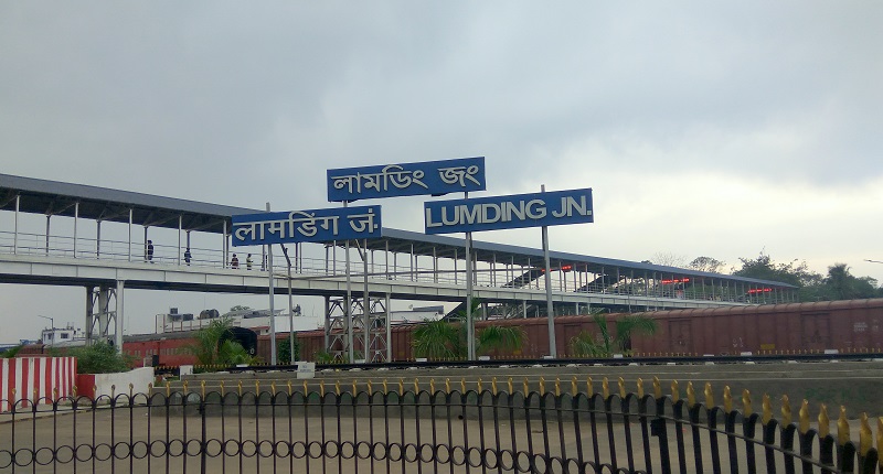
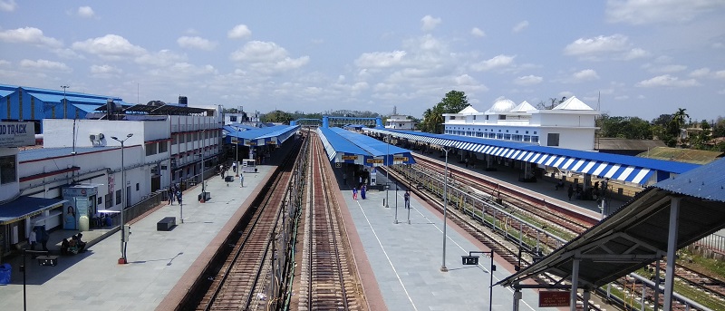
After Lanka, I hardly noticed any vehicle on the highway. The road looked deserted, and the straightway transformed into curves, multiplying my excitement to a hundred times. Lumding is 40 kilometers from Lanka, and I took an hour to cover the distance. The highway is fantastic, and on a few stretches, it looked like I am the only one going to Haflong. Once I reached Lumding, I took the exit from the highway and went to the Lumding Railway Station. I first heard the name of Lumding in the Movie Dil Se(1998), and here I was visiting the same place once I saw in a movie. Lunding Railway Station is one of the five railway divisions under the Northeast Frontier Railway Zone of Indian Railways. At Lumding Railway Station, I asked the same question about Halfong, and now I sensed positivity in answer. Locals at Lumding said it is fine to go Haflong, and there is no issue. It was a significant relief for me, and now I could spend some time in clicking photos of the highway and sites en route.
My Ride Ride-on Lumdin Maibang Stretch of The Highway
Also Read: A Bike Ride To Badrinath Temple In Uttrakhand
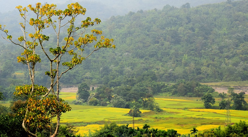
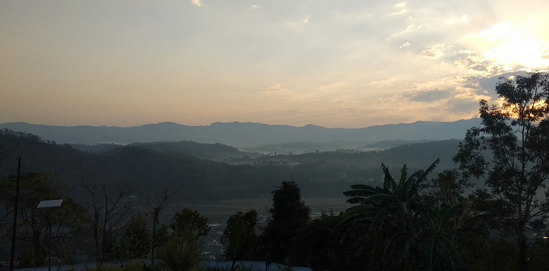
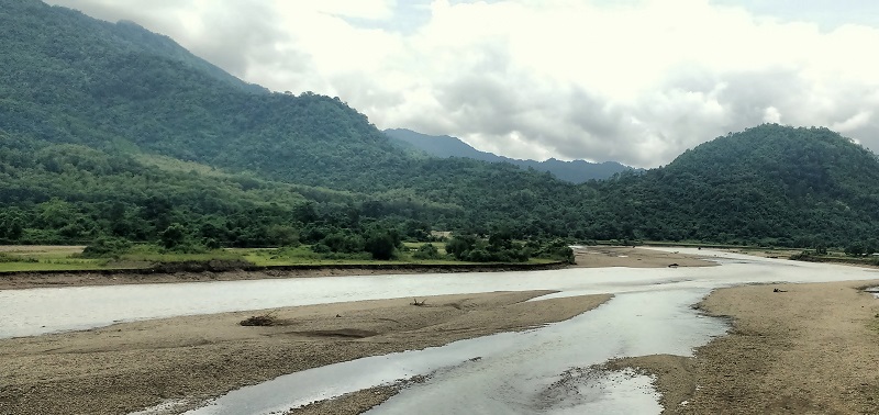
Once I was back on the highway, I continued my ride and planned to take the next break at Maibang. From Lumding, Maibang is about 90 kilometers, and Google Maps suggested 1.5 hours to complete the distance giving me an intuition that highway is going to be a good one. Maibang lies in the Dima Hasao District of Assam, and the town was once the capital of the Dimasa Kachari Kingdom of Assam. Dima Hasao district is the hill district of Assam, and the same was apparent on the road. I have ridden to some of the best highways in India, including the Mumbai-Pune, Yamuna Expressway, and Agra-Lucknow Expressway. I have also done off-roading on my trips to Leh-Ladakh, Sach Pass, and Chanshal Pass, but this highway was beyond comparison. Nowhere on any road in India, I have seen such a dense forest cover on both sides of the road nor witnessed the minimum traffic. The traffic on the highway was negligible, and on a few patches, I noticed wild grasses covering a quarter of the road. While riding on most of the roads in India, you will find dust blowing on the road, and here the case was the opposite. The numerous curves and cold breeze make the ride further memorable. The highway was recently completed after failing multiple deadlines, and pressure from local politicians made things adverse. Earlier people used to think twice before opting for this route, but now this is the best route connecting Haflong to other parts of Assam.
From Lumding, a railway line runs parallel to the highway, and this rail route is one of the best rail routes in India. The hilly terrain through while the railway’s pass gives a feeling of traveling on the mountain railways of India like the Kalka-Shimla Railways and the Nilgiri Railway line. Many small railway stations lie on this route, and I noticed stations entrance from the road. Few stations en-route were Manderdisa, Hatikhali, Dibolong, and Langting. I was so overwhelmed by the area through which the highway and rail route passes that after completing the Lumding-Maibang-Haflong stretch on Bike, I again traveled on the same route by train. I wanted to experience the beauty of southern Assam both via Road and the Railways and boarded Kanchenjunga Express from Guwahati. I will be writing my travelogue of Lumding-Maibang-Haflong travel by railways, in which I will explain why the journey on the railway is a must thing to do.
Although Google Maps showed 1.5 hours to complete the 90 kilometers between Lumding and Maibang, I took around three hours to reach Maibang. Around 4:15 PM, I reached Maibang and again took the exit from the highway and went to the Maibang Railway Station for tea. The railway station looked small and comprised of only a few shops. I ordered tea from one shop and asked about the situation in Haflong. I inquired if it is good to go Haflong or should I try finding a room in Maibang. To this, the shopkeeper replied that it is fine to go Haflong, and there is no problem. He also advised me to reach Haflong before dark to avoid any unpleasant experience. I knew that the sun sets early in the eastern part of India, and I was traveling during the winter season, so I had around one hour of daylight before getting dark. Therefore without wasting any time, I decided to start riding for Haflong.
Ride-On Maibang Haflong Highway, Mahur Tunnel And Reaching Haflong Town
Before leaving Maibang, I also enquired about the road condition ahead as Google Maps showed two hours for covering 50 kilometers, and I knew something is not right. The shopkeeper informed that road till Mahur is good, and from Mahur till Haflong, it is terrible. Keeping this in mind, I started for Haflong and aimed to reach by 6:30 PM. The Mahur river runs parallel to the highway on this stretch, and though the darkness was a concern, I continued enjoying the ride to its fullest extent. By the time I reached the Mahur Tunnel, it had become completely dark. The Mahur Tunnel is a long tunnel constructed through the hills of Dima Hasao. The tunnel, measuring around 2 kilometers, is an excellent example of dedication and commitment N.H.A.I. It took me five minutes to ride through the tunnel and reminded me of my ride to Chenani-Nashri Tunnel during my Leh Ride. Once I crossed the tunnel within a few kilometers, the road started deteriorating. I had to still ride for some 25 kilometers, and when I checked my phone for maps assistance, there was no network signal. I continued riding slowly, cursing myself for wasting time and not following the proper plan.
Luckily I saw one bike going in the same direction, and I asked about the Haflong route. They told me that they are also going to Haflong, and I can follow them. They went fishing at a lake near Mahur and were now returning. I started following them, and indeed, the road was in terrible shape. It looked like construction is going on as I could recognize construction items scattered on the road. After following the bikes for 30 minutes, I sensed good track and an increase in elevation, and I knew that Haflong is nearby. The bike guys stopped at one shop and asked me if I want the tea to which I obliged. They instructed me how to reach the main Haflong town and told me that the city is three kilometers from the shop. I thanked them for their help, and when I tried paying for the tea, they stopped me. For them, I was a tourist, and they wanted to help in the best possible way. Once I left the shop, I was confused because right from Kaziranga, everyone said that Haflong is not safe, and here I found the most helping and generous people in my ten days of North-East India ride.
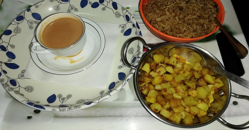
Once I reached Haflong, I quickly found one hotel and booked a room. I ordered dinner at the same time as the market closes early in the hilly areas. Also, I was riding with an empty stomach throughout the day with the last proper meal in the morning. During my 300 kilometers ride on the Lumding-Maibang-Haflong Highway, I mostly had tea when I took a break and nothing substantial. I ordered tea along with fried rice and potato fries. Initially, I planned to go outside and get an idea of the city, but the weather prohibited from doing any exploration. I focused on my next day plan, where I planned to ride from Haflong to Silchar.
Road Condition of Lumding-Maibang-Haflong Highway
Also Read: A Bike Trip To Tamhini Ghat in Western Ghats of India
The Lumding Maibang Haflong highway is well constructed, although the highway passes through one of the most inaccessible parts of Assam and India. The entire road is four-laned from Nagaon till Mahur and construction are going on to complete the highway till Haflong. Since this highway is National Highway 27, its development and operations fall under the command of the National Highway Authority of India (N.H.A.I).
Availability of Petrol Pumps and Resturant on Lumding Haflong Highway
As mentioned, the highway passes through the remote areas of Assam; I didn’t notice any petrol pump on the roadside once I crossed Lanka. The road mostly passes through hills and forests with Lumding and Maibang as only two major towns. Petrol pumps are available in Maibang and Lumding, and I refilled at one in Lumding. If you are running out of fuel, better to exit the main highway at Lumding or Maibang and get the tank filled.
Hotels and Restuarant On Lumding Maibang Haflong Highway
Again the hotel and restaurant are not available on the highway, and one can find them in Maibang and Lumding town. It is better to search for restaurants in Lumding rather than relying on Maibang as Lumding is a bigger town between two. I would recommend to start early morning from Guwahati or Kaziranga and try reaching Haflong by evening. Haflong is a peaceful town, and all my doubts and concerns regarding Haflong cleared when I explored the city the next day.